Category:Maps of La Garrovilla
Jump to navigation
Jump to search
Media in category "Maps of La Garrovilla"
The following 6 files are in this category, out of 6 total.
-
 Karte Gemeinde La Garrovilla 2022.png 5,000 × 3,534; 1.98 MB
-
 La Algarrovilla en el mapa de la provincia de Estremadura (1766).jpg 955 × 773; 449 KB
-
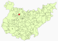
 La Garrovilla - Location.png 532 × 600; 142 KB
-
 La Garrovilla1.png 547 × 388; 98 KB
-
 MTN25-0777c1-1991-La Garrovilla.jpg 7,792 × 5,443; 6.13 MB
-
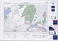 MTN25-0777c1-2003-La Garrovilla.jpg 7,769 × 5,453; 7.87 MB

.jpg)


