Category:Maps of La Chapelle-Saint-Sépulcre
Jump to navigation
Jump to search
Wikimedia category | |||||
| Upload media | |||||
| Instance of | |||||
|---|---|---|---|---|---|
| Category combines topics | |||||
| La Chapelle-Saint-Sépulcre | |||||
commune in Loiret, France   | |||||
| Instance of | |||||
| Location |
| ||||
| Street address |
| ||||
| Population |
| ||||
| Area |
| ||||
 | |||||
Subcategories
This category has only the following subcategory.
Media in category "Maps of La Chapelle-Saint-Sépulcre"
The following 9 files are in this category, out of 9 total.
-
 45 Znieff 72.jpg 5,457 × 3,543; 714 KB
-
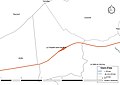
 45-La Chapelle-Saint-Sepulcre-Routes.png 5,457 × 3,543; 1.08 MB
-
 45076-La Chapelle-Saint-Sépulcre-argile.png 3,057 × 2,480; 1.61 MB
-
 45076-La Chapelle-Saint-Sépulcre-Cours eau.jpg 3,507 × 2,480; 290 KB
-
 45076-La Chapelle-Saint-Sépulcre-Hydro.jpeg 5,846 × 4,133; 1.04 MB
-
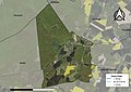 45076-La Chapelle-Saint-Sépulcre-Orthophoto.jpeg 10,559 × 7,440; 13.32 MB
-
 45076-La Chapelle-Saint-Sépulcre-Sols.png 3,519 × 2,480; 996 KB
-
 La Chapelle-Saint-Sépulcre-Interco.png 3,507 × 2,480; 1,006 KB
-
 Map commune FR insee code 45076.png 756 × 605; 34 KB


