Category:Maps of Lünen
Jump to navigation
Jump to search
Wikimedia category | |||||
| Upload media | |||||
| Instance of | |||||
|---|---|---|---|---|---|
| Category combines topics | |||||
| Lünen | |||||
town in Unna District, in North Rhine-Westphalia, Germany     | |||||
| Instance of |
| ||||
| Location | Unna, Arnsberg Government Region, North Rhine-Westphalia, Germany | ||||
| Head of government |
| ||||
| Population |
| ||||
| Area |
| ||||
| Elevation above sea level |
| ||||
| official website | |||||
 | |||||
Media in category "Maps of Lünen"
The following 15 files are in this category, out of 15 total.
-
 2020 Lünen City Council election.svg 997 × 633; 214 KB
-
 DB 2112 railway map.png 1,583 × 1,087; 1.95 MB
-
 IMG 2667-Kreis-Lüdinghausen-1893.jpg 1,817 × 1,493; 2.64 MB
-
 Karte des Datteln-Hamm-Kanals.png 2,672 × 906; 1.2 MB
-
 Lage der Stadt Lünen in Deutschland.png 188 × 235; 5 KB
-
 Luenen Kreis Unna.gif 295 × 367; 23 KB
-
 Lünen in UN.svg 336 × 396; 258 KB
-
 Lünen Siedlung Ziethenstrasse OSM.png 868 × 886; 238 KB
-
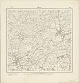 Messtischblatt 4311 Luenen 1907.jpg 8,305 × 8,713; 13.19 MB
-
 Radrevier.ruhr Knotenpunkt 17 Schloss Schwansbell Karte.jpg 3,672 × 4,896; 6.82 MB
-
 Radrevier.ruhr Knotenpunkt 18 Lünen-Beckinghausen Karte.jpg 3,672 × 4,896; 7.13 MB
-
 Radrevier.ruhr Knotenpunkt 20 Preußenhafen Lünen Karte.jpg 3,672 × 4,896; 6.76 MB
-
 Radrevier.ruhr Knotenpunkt 21 Lünen-Süd Karte.jpg 3,672 × 4,896; 6.35 MB
-
 Radrevier.ruhr Knotenpunkt 24 Bahnhof Lünen Karte.jpg 3,672 × 4,896; 6.77 MB
-
 Radrevier.ruhr Knotenpunkt 25 Schlossmühle Buddenburg Karte.jpg 3,672 × 4,896; 6.62 MB


