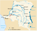
Category:Maps of Kwango River
Jump to navigation
Jump to search
Media in category "Maps of Kwango River"
The following 7 files are in this category, out of 7 total.
-
Angola-DRC boundary. LOC 84692090.jpg 5,721 × 4,136; 2.34 MB
-
Kwango jõgi.svg 671 × 559; 124 KB
-
Kwango River DRC nl.svg 671 × 559; 368 KB
-
Kwango River DRC.svg 671 × 559; 124 KB
-
Kwango River.png 1,193 × 705; 1.45 MB
-
Situation of Kenge between the Kwango, Wamba and Bakali rivers.svg 1,819 × 766; 57 KB


