Category:Maps of Kutch
Jump to navigation
Jump to search
Media in category "Maps of Kutch"
The following 15 files are in this category, out of 15 total.
-
Gujarat district location map Kutch.svg 1,639 × 1,852; 744 KB
-
Gujarat Geological map.jpg 887 × 534; 367 KB
-
Gujarat Kachchh district.png 2,182 × 1,724; 558 KB
-
Gulf of Kutch 1896.png 3,204 × 2,230; 2.66 MB
-
Gulf of Kutch West half.jpg 1,664 × 2,650; 476 KB
-
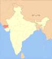
India Kutch locator map.svg 1,639 × 1,852; 795 KB
-
India-Pak border west.png 1,217 × 874; 312 KB
-
India-Pakistan Boundary in the Rann of Kutch.jpg 2,895 × 2,082; 1.43 MB
-
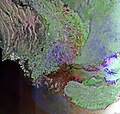
Indus River - Envisat.jpg 1,440 × 1,370; 1.09 MB
-
Kachch.png 1,058 × 749; 143 KB
-
Little Rann of Kutch East Part 1896.jpg 1,664 × 2,650; 758 KB
-
Little Rann of Kutch West Part 1896.jpg 1,664 × 2,650; 636 KB
-
Map GujDist Kuchchh.png 1,058 × 749; 63 KB
-
The Rann of Cutch, in a map from the 1880's.jpg 618 × 447; 69 KB


