Category:Maps of Krk
Jump to navigation
Jump to search
Media in category "Maps of Krk"
The following 14 files are in this category, out of 14 total.
-
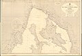 Admiralty Chart No 2719 Rt Ubas and Sveti Juraj to Rijeka, Published 1961.jpg 16,237 × 11,069; 44.51 MB
-
 Croatia - Krk.PNG 815 × 553; 47 KB
-
 CroatiaKrk.png 200 × 198; 19 KB
-
 Karte Camino Krk.png 1,340 × 817; 807 KB
-
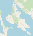 Krk location map.png 1,910 × 2,074; 756 KB
-
 Krk map.png 400 × 400; 115 KB
-
 Krk.jpg 300 × 350; 17 KB
-
 Krk.svg 557 × 612; 97 KB
-

-
 Notes ecclesiological and picturesque page 91.png 789 × 754; 350 KB
-
 Simple map of Island of Krk.svg 334 × 414; 348 KB
-
 Stielers Handatlas 1891 20.jpg 5,050 × 4,200; 7.28 MB
-
 Veglia und Novi. NYPL1226897.tiff 5,547 × 4,616; 73.3 MB
-
 Востраў Крк.png 400 × 400; 32 KB


,_Kres_(Cherso),_Rab_(Arbe)_and_Pag_(Pago)_islands,_and_of_the_Dalmatian_coast,_with_the_cities_of_Sen_-_Bordone_Benedetto_-_1547.jpg)


