Category:Maps of Konya Province
Jump to navigation
Jump to search
Wikimedia category | |||||
| Upload media | |||||
| Instance of | |||||
|---|---|---|---|---|---|
| Category combines topics | |||||
| Konya Province | |||||
province of Turkey | |||||
| Instance of | |||||
| Part of | |||||
| Location | Turkey | ||||
| Capital | |||||
| Population |
| ||||
| official website | |||||
 | |||||
Subcategories
This category has the following 3 subcategories, out of 3 total.
Media in category "Maps of Konya Province"
The following 20 files are in this category, out of 20 total.
-
Locator map-Konya Province.png 1,024 × 440; 145 KB
-
Konya in Turkey.svg 1,579 × 677; 1.67 MB
-
Latrans-Turkey location Konya.svg 1,473 × 655; 10.88 MB
-
Akşehir district in Konya, Turkey.svg 630 × 885; 1.99 MB
-
Asia Minor 1 to 250.000. Series G.S.G.S. no. 2097 - Sheet Konia.tif 9,105 × 9,126; 79.24 MB
-
Dolinenkarte des Kreises Karapınar.png 2,342 × 2,102; 4.96 MB
-
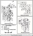
Grundrisspläne von Muhacir-Dörfern in Inner-Anatolien.jpg 849 × 907; 241 KB
-
Karapınar Obruk Haritası.jpg 3,307 × 2,974; 2.38 MB
-
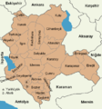
Konya City Province.png 561 × 600; 104 KB
-
Konya harita.svg 1,052 × 744; 43 KB
-
Konya location districts.png 655 × 700; 93 KB
-
Konya Mahalleleri Yol Ağı.jpg 3,507 × 2,256; 5 MB
-
Konya plain topographic map-blank.svg 1,665 × 1,202; 774 KB
-
Konya topographic location map.png 928 × 940; 1.39 MB
-
Konya Turkey Provinces locator.jpg 600 × 280; 28 KB
-
Konya-Ereğli Ovası Situationsskizze.jpg 1,942 × 1,091; 783 KB
-
Osman Orhan Obruk Çalışma.jpg 2,751 × 1,998; 1.12 MB
-
Siedlungsentwicklung der Konya-Ereğli Ovası seit dem 16. Jahrhundert.jpg 2,301 × 1,131; 697 KB
-
Travertinkegel bei Ilıca Yaylası (Türkei).jpg 824 × 1,102; 301 KB


