Category:Maps of Kingston upon Hull
Jump to navigation
Jump to search
Wikimedia category | |||||
| Upload media | |||||
| Instance of | |||||
|---|---|---|---|---|---|
| Category combines topics | |||||
| Kingston upon Hull | |||||
city in the East Riding of Yorkshire, England  El Museu Marítim   | |||||
| Pronunciation audio | |||||
| Instance of | |||||
| Location | City of Kingston upon Hull, East Riding of Yorkshire, Yorkshire and the Humber, England | ||||
| Inception |
| ||||
| Significant event |
| ||||
| Population |
| ||||
| Area |
| ||||
| Different from | |||||
| official website | |||||
 | |||||
Subcategories
This category has the following 4 subcategories, out of 4 total.
E
Media in category "Maps of Kingston upon Hull"
The following 23 files are in this category, out of 23 total.
-
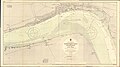 Admiralty Chart No 3497 Thorngumbald Lights to Barton Haven, Published 1913, New Edition 1954.jpg 20,085 × 11,210; 89.39 MB
-
 EnglandHull.png 200 × 247; 23 KB
-
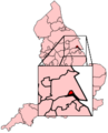
 Hull in the UK.png 328 × 494; 40 KB
-
 Hull map.jpg 822 × 637; 115 KB
-
 Hull RJD 37.JPG 2,735 × 1,802; 759 KB
-
 HullEastConstituency.svg 200 × 200; 38 KB
-
 HullNorthConstituency.svg 200 × 200; 38 KB
-
 HullWestHessleConstituency.svg 200 × 200; 38 KB
-
 Kingston upon Hull OSM 01.png 814 × 786; 966 KB
-
 Kingston upon Hull OSM 02.png 814 × 786; 1.15 MB
-
 Kingston upon Hull OSM 03.png 1,306 × 1,096; 1.62 MB
-
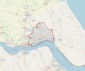
 Kingston upon Hull UK locator map.svg 1,425 × 1,107; 767 KB
-
 Kingston upon Hull UK parish locator map.svg 1,425 × 1,107; 1.68 MB
-
 Kingston upon Hull UK ward map 2010 (blank).svg 1,319 × 1,305; 179 KB
-
 Kingston upon Hull UK ward map 2018 (blank).svg 1,319 × 1,305; 195 KB
-
 KingstonUponHullEast2007Constituency.svg 210 × 207; 134 KB
-
 KingstonUponHullNorth2007Constituency.svg 210 × 207; 134 KB
-
 KingstonUponHullWestHessle2007Constituency.svg 210 × 207; 134 KB
-
 Ordnance Survey One-Inch Sheet 99 Hull, Published 1947.jpg 8,469 × 10,479; 8.29 MB
-
 Ordnance Survey One-Inch Sheet 99 Hull, Published 1962.jpg 8,275 × 9,915; 7.41 MB
-
 Sentamu Academy.png 524 × 372; 110 KB
-
 The Seed Catalogue.Hagan.jpg 891 × 1,037; 760 KB
-
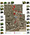
 Tour of Sewell Group Craven Park External Map & Signage.jpg 4,176 × 2,784; 3.4 MB


.svg)
.svg)