Category:Maps of Kham
Jump to navigation
Jump to search
Subcategories
This category has only the following subcategory.
Media in category "Maps of Kham"
The following 71 files are in this category, out of 71 total.
-
 'Front of Tibet' Map Painted by Wu Run-De (1907).jpg 1,000 × 827; 299 KB
-
 Der Jesuiten-Atlas der Kanghsi-Zeit - China und die Aussenlaender LOC 74650033-12.jpg 12,186 × 9,694; 12.61 MB
-
 Der Jesuiten-Atlas der Kanghsi-Zeit - China und die Aussenlaender LOC 74650033-12.tif 12,186 × 9,694; 337.98 MB
-
 Der Jesuiten-Atlas der Kanghsi-Zeit - China und die Aussenlaender LOC 74650033-17.jpg 7,498 × 9,654; 6.87 MB
-
 Der Jesuiten-Atlas der Kanghsi-Zeit - China und die Aussenlaender LOC 74650033-17.tif 7,498 × 9,654; 207.1 MB
-
 Der Jesuiten-Atlas der Kanghsi-Zeit - China und die Aussenlaender LOC 74650033-18.jpg 7,414 × 9,618; 6.83 MB
-
 Der Jesuiten-Atlas der Kanghsi-Zeit - China und die Aussenlaender LOC 74650033-18.tif 7,414 × 9,618; 204.01 MB
-

-
-
-

-

-

-

-

-

-
 Anville Nouvel atlas de la Chine - Page15 Chine generale couleur.jpg 2,500 × 1,755; 2.87 MB
-
 Anville Nouvel atlas de la Chine - Page87 - thibet bhoutan generale.jpg 5,112 × 4,048; 8.6 MB
-
 Anville Nouvel atlas de la Chine - Page97 - thibet 5e feuille si fan.jpg 2,816 × 4,336; 4.86 MB
-

-
 CEM-44-La-Chine-la-Tartarie-Chinoise-et-le-Thibet-1734-2568.jpg 2,552 × 1,832; 2.5 MB
-

-

-

-
 1837 Malte-Brun Map of China and Japan - Geographicus - China-mb-1837.jpg 2,328 × 1,758; 772 KB
-
 1912 China map from National Geographic.jpg 6,980 × 5,326; 10.65 MB
-
 1922 Map of India by Bartholomew in Imperial Gazetteer of India.jpg 3,729 × 3,449; 4.79 MB
-

-

-

-

-
 Brit IndianEmpireReligions3.jpg 1,534 × 1,241; 2.33 MB
-
 Buddhist sects.png 1,365 × 1,249; 236 KB
-

-
 China Proper Map William Mackenzie c1866.png 2,449 × 3,080; 15.13 MB
-
 China Proper.jpg 564 × 698; 160 KB
-
 Geographic locations of Qiangic and other East Asian populations.png 4,519 × 2,456; 1.41 MB
-
 Han Civilisation.png 880 × 650; 1 MB
-
 Han foreign relations CE 2.jpg 965 × 650; 558 KB
-
 Historic Tibet Map v češtině.png 970 × 608; 99 KB
-

-
-
 Map illustrating Edward Amundsen's journey in Sechuen, East Tibet and Yunnan.webp 1,025 × 1,600; 268 KB
-

-
 Map of Ming Chinese empire 1415 (cropped).jpg 1,440 × 2,178; 389 KB
-
 Map of Ming Chinese empire 1415.jpg 1,577 × 2,339; 451 KB
-
 Map of Tibet in 1798, from- Map China c1798 (cropped).jpg 348 × 255; 40 KB
-
 Map of Tibet in 1875 from China Proper map (cropped).jpg 182 × 365; 45 KB
-
 Map of Tibet in 1900, from- A map of China LOC 2007633876 (cropped).jpg 3,099 × 6,704; 3.69 MB
-

-
 Map of Tibet in 1909 (cropped).jpg 834 × 333; 416 KB
-
-

-

-
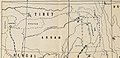
 Map of Tibet Ü-Tsang Amdo and Kham.jpg 295 × 187; 25 KB
-

-

-

-
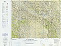 NH-47-3 Garze China.jpg 8,544 × 6,586; 8 MB
-
 Regni Sinae vel Sinae Propriae Mappa et Descriptio Geographica.jpg 6,416 × 7,071; 9.98 MB
-
 Salween River basin map.svg 317 × 518; 12.94 MB
-
 Simla Accord Treaty 1914 Map1.jpg 800 × 629; 151 KB
-
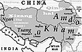
 Simla Convention - contending claims in Kham.jpg 1,725 × 1,397; 872 KB
-
 Simla Convention and ROC control in Kham.jpg 1,711 × 1,171; 745 KB
-
 Simla Convention borders in Kham.jpg 2,877 × 2,061; 1.38 MB
-
 Tibet ethnolinguistic 1967.png 668 × 386; 433 KB
-

-

-
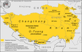
 Tibet provinces.png 1,421 × 986; 871 KB
-
 Tibetischer Kulturraum Karte 2.png 1,500 × 951; 454 KB
-
 Tibetischer Kulturraum Karte.png 1,500 × 951; 446 KB
.jpg)


.jpg)

.jpg)


_(14763682842).jpg)
.jpg)


_north_east.jpg)


.jpg)
_(14784338845).jpg)


.jpg)

.jpg)
.jpg)
.jpg)
_(14576990459)_(cropped).jpg)
_(cropped).jpg)
_about_the_year_1750_from_Regni_Sinae_vel_Sinae_Propriae_Mappa_et_Descriptio_Geographica_(cropped).jpg)
.png)

_(cropped).jpg)
.jpg)


.jpg)


.jpg)
_(cropped).jpg)