Category:Maps of Kenora District
Jump to navigation
Jump to search
Media in category "Maps of Kenora District"
The following 10 files are in this category, out of 10 total.
-
 Annual report (1920) (14592332879).jpg 3,136 × 2,034; 722 KB
-
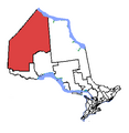 Kenora, riding.png 370 × 381; 8 KB
-
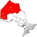
 Kenora-rainyriver.PNG 896 × 797; 28 KB
-
 Map of Ontario KENORA.svg 340 × 330; 84 KB
-
 Ontario Sessional Papers, 1897-98, No.33-66 (1905) (14597846270).jpg 2,180 × 3,172; 562 KB
-
 Ontario Sessional Papers, 1897-98, No.33-66 (1905) (14597942398).jpg 3,032 × 2,423; 549 KB
-
 Ontken.png 378 × 379; 9 KB
-
 Redditt station OSM map.png 1,050 × 645; 195 KB
-
 Unorg Kenora.png 378 × 379; 6 KB
-

_(14592332879).jpg)


_(14597846270).jpg)
_(14597942398).jpg)


