Category:Maps of Kaunas District Municipality
Jump to navigation
Jump to search
Subcategories
This category has the following 4 subcategories, out of 4 total.
G
- Garliava in maps (6 F)
V
- Vilkija in maps (6 F)
Media in category "Maps of Kaunas District Municipality"
The following 7 files are in this category, out of 7 total.
-
 Kaunas district in Lithuania.svg 1,095 × 821; 524 KB
-
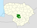
 Kaunas district location.png 623 × 503; 20 KB
-
 Kaunas district location.svg 1,095 × 821; 118 KB
-
 Kaunas dst.svg 1,000 × 800; 717 KB
-
 Kauno Apskrities Bendrojo Plano Koncepcija. 2005 m.jpg 5,906 × 5,906; 8.68 MB
-
 Kauno rajono savivaldybė.svg 968 × 953; 83 KB
-
 Kauno rajono zemelapis.png 1,035 × 1,029; 243 KB


