Category:Maps of Kauai County, Hawaii
Jump to navigation
Jump to search
Wikimedia category | |||||
| Upload media | |||||
| Instance of | |||||
|---|---|---|---|---|---|
| Category combines topics | |||||
| Kauai County | |||||
county in Hawaii, United States   | |||||
| Instance of | |||||
| Named after | |||||
| Location | Hawaii | ||||
| Capital | |||||
| Inception |
| ||||
| Population |
| ||||
| Area |
| ||||
| official website | |||||
 | |||||
Media in category "Maps of Kauai County, Hawaii"
The following 57 files are in this category, out of 57 total.
-

-
 Halalii Lake on topo map of southern Niihau Island, Hawaii.jpg 609 × 592; 196 KB
-
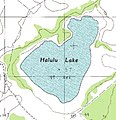 Halulu Lake on topo map of southern Niihau Island, Hawaii.jpg 441 × 457; 50 KB
-
 HIMap-doton-Hanalei.PNG 300 × 172; 4 KB
-
 HIMap-doton-Hanapepe.PNG 300 × 172; 4 KB
-
 HIMap-doton-Kalaheo.PNG 300 × 172; 4 KB
-
 HIMap-doton-Kalihiwai.PNG 300 × 172; 4 KB
-
 HIMap-doton-Kaumakanai.PNG 300 × 172; 4 KB
-
 HIMap-doton-Kekaha.PNG 300 × 172; 4 KB
-
 HIMap-doton-Kilauea.PNG 300 × 172; 4 KB
-
 HIMap-doton-Lawai.PNG 300 × 172; 4 KB
-
 HIMap-doton-Lihue.PNG 300 × 172; 4 KB
-
 HIMap-doton-Omao.PNG 300 × 172; 4 KB
-
 HIMap-doton-PakalaVillage.PNG 300 × 172; 4 KB
-
 HIMap-doton-Poipu.PNG 300 × 172; 4 KB
-
 HIMap-doton-Puhi.PNG 300 × 172; 4 KB
-
 HIMap-doton-Wailua.PNG 300 × 172; 4 KB
-
 A history of the United States of America, its people, and its institutions (IA historyofuniteds03morr).pdf 764 × 1,206, 650 pages; 39.49 MB
-
 Kapaa, HI Micropolitan Statistical Area (detail).png 861 × 520; 42 KB
-
 Kapaa, HI Micropolitan Statistical Area.png 830 × 1,077; 70 KB
-
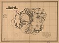
 Kauai 1838 map by Kalama.jpg 520 × 387; 148 KB
-

-

-

-

-

-

-

-

-

-

-

-

-

-

-

-

-

-

-
-

-
-

-
 Kauai F21159G3 geo.jpg 10,628 × 6,752; 6.27 MB
-
 Kauai government survey, 1878 LOC 2005625315.jpg 7,989 × 5,861; 6.32 MB
-
 Kauai government survey, 1878 LOC 2005625315.tif 7,989 × 5,861; 133.96 MB
-

-
 Kauai, Hawaiian Islands, 1903 - $c Walter E. Wall, surveyor ; compiled by John M. Donn. LOC 2008627967.tif 14,075 × 11,036; 444.41 MB
-
 Kaula.png 579 × 695; 891 KB
-
 Lehua.png 1,369 × 738; 2 MB
-
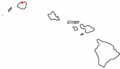
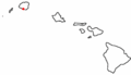
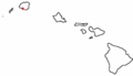
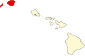 Map of Hawaii highlighting Kauai County.svg 1,416 × 920; 12 KB
-
 Natural history of Hawaii (Page 104) (7153450071).jpg 2,853 × 1,864; 717 KB
-
 Niihau from F21159G3 geo (cropped).jpg 2,537 × 3,445; 568 KB
-
 Niihau North K21160H1 geo.pdf 6,997 × 3,837; 13.56 MB
-
 Niihau South K21160G1 geo.pdf 7,004 × 3,837; 12.61 MB
-
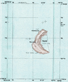
 Nonopapa, Halulu and Halalii Lakes.jpg 1,039 × 536; 168 KB
-
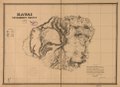
 Originalkarte von Kauai Niihau &c.png 2,390 × 1,859; 3.91 MB
_(14598209770).jpg)


.png)


_(7153450071).jpg)
.jpg)

