Category:Maps of Kashubia
Jump to navigation
Jump to search
Subcategories
This category has the following 2 subcategories, out of 2 total.
M
- Maps of the Kashubians (10 F)
Media in category "Maps of Kashubia"
The following 17 files are in this category, out of 17 total.
-
 01645 Blaeu 1645 - Germaniae veteris typus, Suevi, cropped.png 1,559 × 904; 2.83 MB
-

-
 Kashubian language and nationality.png 2,858 × 1,825; 1.12 MB
-
 Kashubians in Poland with polstats big.png 2,726 × 2,558; 428 KB
-
 Kashubians in Poland without text.png 835 × 794; 43 KB
-
 Kashubians in Poland.png 955 × 916; 95 KB
-
 Kaszubians in Poland.svg 2,750 × 2,600; 24 KB
-
 Kaszuby - grupy lokalne.png 2,607 × 2,573; 1.33 MB
-
 Kaszuby wg J.Mordawskiego 1999.png 2,153 × 2,225; 573 KB
-
 Kaszuby-mapa.png 612 × 588; 71 KB
-
 Kaszëbë (Kashubia) map only in kashubian.png 2,233 × 2,500; 687 KB
-
 Kaszëbë (Kashubia) map.png 1,497 × 1,733; 448 KB
-
 Kôrta Kraju Kaszëbów.jpg 580 × 590; 162 KB
-
 Pologne.jpg 2,352 × 3,030; 1.74 MB
-
 Pommerellen Slavische Völker bis 1125.jpg 1,750 × 1,152; 1.59 MB
-
 Porenkowo Pomorsko 1.png 358 × 563; 111 KB
-
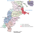
 Powiat na mapie Kaszub.png 576 × 587; 522 KB


_map_only_in_kashubian.png)
_map.png)


