Category:Maps of Karawang Regency
Jump to navigation
Jump to search
| NO WIKIDATA ID FOUND! Search for Maps of Karawang Regency on Wikidata | |
| Upload media |
Subcategories
This category has only the following subcategory.
!
Media in category "Maps of Karawang Regency"
The following 63 files are in this category, out of 63 total.
-
 (500)Peta Indeks Wilayah 2010 Provinsi Jawa Barat.jpg 1,685 × 1,192; 407 KB
-
 (501)Peta Indeks Wilayah 2010 Provinsi Jawa Barat.jpg 1,685 × 1,192; 446 KB
-
 (502)Peta Indeks Wilayah 2010 Provinsi Jawa Barat.jpg 1,685 × 1,192; 396 KB
-
 (503)Peta Indeks Wilayah 2010 Provinsi Jawa Barat.jpg 1,685 × 1,192; 399 KB
-
 (504)Peta Indeks Wilayah 2010 Provinsi Jawa Barat.jpg 1,685 × 1,192; 433 KB
-
 (505)Peta Indeks Wilayah 2010 Provinsi Jawa Barat.jpg 1,685 × 1,192; 439 KB
-
 (506)Peta Indeks Wilayah 2010 Provinsi Jawa Barat.jpg 1,685 × 1,192; 426 KB
-
 (507)Peta Indeks Wilayah 2010 Provinsi Jawa Barat.jpg 1,685 × 1,192; 396 KB
-
 (508)Peta Indeks Wilayah 2010 Provinsi Jawa Barat.jpg 1,685 × 1,192; 416 KB
-
 (509)Peta Indeks Wilayah 2010 Provinsi Jawa Barat.jpg 1,685 × 1,192; 459 KB
-
 (510)Peta Indeks Wilayah 2010 Provinsi Jawa Barat.jpg 1,685 × 1,192; 438 KB
-
 (511)Peta Indeks Wilayah 2010 Provinsi Jawa Barat.jpg 1,685 × 1,192; 421 KB
-
 (512)Peta Indeks Wilayah 2010 Provinsi Jawa Barat.jpg 1,685 × 1,192; 491 KB
-
 (513)Peta Indeks Wilayah 2010 Provinsi Jawa Barat.jpg 1,685 × 1,192; 462 KB
-
 (514)Peta Indeks Wilayah 2010 Provinsi Jawa Barat.jpg 1,685 × 1,192; 413 KB
-
 (515)Peta Indeks Wilayah 2010 Provinsi Jawa Barat.jpg 1,685 × 1,192; 455 KB
-
 (516)Peta Indeks Wilayah 2010 Provinsi Jawa Barat.jpg 1,685 × 1,192; 396 KB
-
 (517)Peta Indeks Wilayah 2010 Provinsi Jawa Barat.jpg 1,685 × 1,191; 413 KB
-
 (518)Peta Indeks Wilayah 2010 Provinsi Jawa Barat.jpg 1,685 × 1,192; 415 KB
-
 (519)Peta Indeks Wilayah 2010 Provinsi Jawa Barat.jpg 1,685 × 1,192; 476 KB
-
 (520)Peta Indeks Wilayah 2010 Provinsi Jawa Barat.jpg 1,685 × 1,192; 524 KB
-
 (521)Peta Indeks Wilayah 2010 Provinsi Jawa Barat.jpg 1,685 × 1,192; 457 KB
-
 (522)Peta Indeks Wilayah 2010 Provinsi Jawa Barat.jpg 1,685 × 1,192; 419 KB
-
 (523)Peta Indeks Wilayah 2010 Provinsi Jawa Barat.jpg 1,685 × 1,192; 401 KB
-
 (524)Peta Indeks Wilayah 2010 Provinsi Jawa Barat.jpg 1,685 × 1,192; 470 KB
-
 (525)Peta Indeks Wilayah 2010 Provinsi Jawa Barat.jpg 1,685 × 1,192; 444 KB
-
 (526)Peta Indeks Wilayah 2010 Provinsi Jawa Barat.jpg 1,685 × 1,192; 475 KB
-
 (527)Peta Indeks Wilayah 2010 Provinsi Jawa Barat.jpg 1,685 × 1,192; 443 KB
-
 (528)Peta Indeks Wilayah 2010 Provinsi Jawa Barat.jpg 1,685 × 1,192; 422 KB
-
 (529)Peta Indeks Wilayah 2010 Provinsi Jawa Barat.jpg 1,685 × 1,192; 429 KB
-
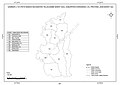
 1209-523 KRW BKB.jpg 8,259 × 7,626; 61.25 MB
-
 Banyusari.png 2,000 × 2,000; 364 KB
-
 Batujaya.png 2,000 × 2,000; 364 KB
-
 Ciampel.png 2,000 × 2,000; 364 KB
-
 Cibuaya.png 2,000 × 2,000; 364 KB
-
 Cikampek.png 2,000 × 2,000; 364 KB
-
 Cilamaya Kulon.png 2,000 × 2,000; 364 KB
-
 Cilamaya Wetan.png 2,000 × 2,000; 364 KB
-
 Cilebar.png 2,000 × 2,000; 364 KB
-
 Jatisari.png 2,000 × 2,000; 364 KB
-
 Jayakerta.png 2,000 × 2,000; 364 KB
-
 Karawang Barat.png 2,000 × 2,000; 364 KB
-
 Karawang Timur.png 2,000 × 2,000; 364 KB
-
 Klari.png 2,000 × 2,000; 364 KB
-
 Kotabaru.png 2,000 × 2,000; 364 KB
-
 Kutawaluya.png 2,000 × 2,000; 364 KB
-
 Lemahabang.png 2,000 × 2,000; 364 KB
-
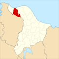
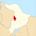
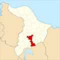
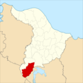
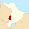
 Locator kabupaten karawang.png 243 × 171; 4 KB
-
 Majalaya.png 2,000 × 2,000; 364 KB
-
 Pakisjaya.png 2,000 × 2,000; 364 KB
-
 Pangkalan.png 2,000 × 2,000; 364 KB
-
 Pedes.png 2,000 × 2,000; 364 KB
-
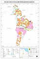 Peta Telukjambe Timur 2011.jpg 3,402 × 4,960; 1.98 MB
-
 Purwasari.png 2,000 × 2,000; 364 KB
-
 Rawamerta.png 2,000 × 2,000; 364 KB
-
 Rengasdengklok.png 2,000 × 2,000; 364 KB
-
 Tegalwaru.png 2,000 × 2,000; 364 KB
-
 Telagasari.png 2,000 × 2,000; 364 KB
-
 Telukjambe Barat.png 2,000 × 2,000; 364 KB
-
 Telukjambe Timur.png 2,000 × 2,000; 364 KB
-
 Tempuran.png 2,000 × 2,000; 364 KB
-
 Tirtajaya.png 2,000 × 2,000; 364 KB
-
 Tirtamulya.png 2,000 × 2,000; 364 KB
Peta_Indeks_Wilayah_2010_Provinsi_Jawa_Barat.jpg)
Peta_Indeks_Wilayah_2010_Provinsi_Jawa_Barat.jpg)
Peta_Indeks_Wilayah_2010_Provinsi_Jawa_Barat.jpg)
Peta_Indeks_Wilayah_2010_Provinsi_Jawa_Barat.jpg)
Peta_Indeks_Wilayah_2010_Provinsi_Jawa_Barat.jpg)
Peta_Indeks_Wilayah_2010_Provinsi_Jawa_Barat.jpg)
Peta_Indeks_Wilayah_2010_Provinsi_Jawa_Barat.jpg)
Peta_Indeks_Wilayah_2010_Provinsi_Jawa_Barat.jpg)
Peta_Indeks_Wilayah_2010_Provinsi_Jawa_Barat.jpg)
Peta_Indeks_Wilayah_2010_Provinsi_Jawa_Barat.jpg)
Peta_Indeks_Wilayah_2010_Provinsi_Jawa_Barat.jpg)
Peta_Indeks_Wilayah_2010_Provinsi_Jawa_Barat.jpg)
Peta_Indeks_Wilayah_2010_Provinsi_Jawa_Barat.jpg)
Peta_Indeks_Wilayah_2010_Provinsi_Jawa_Barat.jpg)
Peta_Indeks_Wilayah_2010_Provinsi_Jawa_Barat.jpg)
Peta_Indeks_Wilayah_2010_Provinsi_Jawa_Barat.jpg)
Peta_Indeks_Wilayah_2010_Provinsi_Jawa_Barat.jpg)
Peta_Indeks_Wilayah_2010_Provinsi_Jawa_Barat.jpg)
Peta_Indeks_Wilayah_2010_Provinsi_Jawa_Barat.jpg)
Peta_Indeks_Wilayah_2010_Provinsi_Jawa_Barat.jpg)
Peta_Indeks_Wilayah_2010_Provinsi_Jawa_Barat.jpg)
Peta_Indeks_Wilayah_2010_Provinsi_Jawa_Barat.jpg)
Peta_Indeks_Wilayah_2010_Provinsi_Jawa_Barat.jpg)
Peta_Indeks_Wilayah_2010_Provinsi_Jawa_Barat.jpg)
Peta_Indeks_Wilayah_2010_Provinsi_Jawa_Barat.jpg)
Peta_Indeks_Wilayah_2010_Provinsi_Jawa_Barat.jpg)
Peta_Indeks_Wilayah_2010_Provinsi_Jawa_Barat.jpg)
Peta_Indeks_Wilayah_2010_Provinsi_Jawa_Barat.jpg)
Peta_Indeks_Wilayah_2010_Provinsi_Jawa_Barat.jpg)
Peta_Indeks_Wilayah_2010_Provinsi_Jawa_Barat.jpg)


