Category:Maps of Kantō region
Jump to navigation
Jump to search
Wikimedia category | |||||
| Upload media | |||||
| Instance of | |||||
|---|---|---|---|---|---|
| Category combines topics | |||||
| Kantō region | |||||
one of 8 regions in Japan encompassing 7 prefectures | |||||
| Instance of | |||||
| Part of | |||||
| Named after |
| ||||
| Location | Japan | ||||
| Has part(s) | |||||
| Population |
| ||||
| Area |
| ||||
| Partially coincident with |
| ||||
 | |||||
Subcategories
This category has the following 5 subcategories, out of 5 total.
Media in category "Maps of Kantō region"
The following 58 files are in this category, out of 58 total.
-
CIT map.jpg 3,326 × 3,403; 2.21 MB
-
Detailed map of the eight provinces of the Kantō region (14961991615).jpg 2,271 × 2,000; 1.87 MB
-
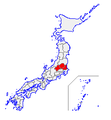
Eight regions of japan3 kanto.png 500 × 400; 22 KB
-
Gas Fields of Minami-Kanto.png 566 × 496; 34 KB
-
Geofeatures map of Kanto Japan ja.svg 700 × 700; 1.94 MB
-
Japan Kanto Map Chikei.gif 570 × 465; 128 KB
-
Japan kanto map small.png 235 × 300; 6 KB
-
Japan Kanto Map.png 2,716 × 2,946; 2.37 MB
-
Japan Kanto Region large.png 1,397 × 1,593; 79 KB
-
Japan Kanto Region.png 366 × 327; 14 KB
-
Japan Kanto telephone code areas.svg 400 × 500; 198 KB
-
Japan location map with side map of the Greater Tokyo Area.svg 500 × 452; 91 KB
-
Japan location map with Tokyo Greater Area Inset.svg 413 × 373; 2.05 MB
-
Japan-kanto p23.png 1,200 × 1,200; 177 KB
-
JpLargeMap KantoTokai.png 1,260 × 919; 43 KB
-
Kanto (Tokyo) Plain Relief Map - DPLA - a81615836b5e3c50702a24a4d46c9605.jpg 9,607 × 7,537; 9.95 MB
-
Kanto Region Administration Map TC.png 600 × 600; 42 KB
-
Kanto Region in Japan (extended).svg 580 × 578; 1.58 MB
-
Kanto Region in Japan (narrow).svg 271 × 363; 1.71 MB
-
Kanto Region in Japan.svg 413 × 373; 1.58 MB
-
Kanto region.svg 800 × 866; 17 KB
-
Kanto-daisotsuritsu2010.png 1,800 × 1,800; 301 KB
-
KantoGrey.png 300 × 300; 17 KB
-
Kantomap-jp.png 585 × 554; 307 KB
-
Kita-kanto- map.png 235 × 255; 4 KB
-
Kitakanto hrdist map 2003.PNG 902 × 530; 31 KB
-
Map of Japan highlighting the Greater Tokyo Area.PNG 295 × 313; 12 KB
-
Minamikanto hrdist map 2003.PNG 968 × 450; 26 KB
-
Municipal flag map of Kanto.jpg 1,280 × 1,009; 178 KB
-
National capital region.png 566 × 496; 27 KB
-
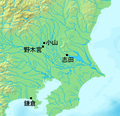
NogimiyaBattle map.png 300 × 290; 123 KB
-
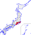
North Kanto in Japan (w Saitama).svg 413 × 373; 953 KB
-
NorthernKanto-region1 Small.PNG 199 × 228; 3 KB
-
NorthernKanto-region2 Small.PNG 199 × 228; 2 KB
-
NorthKanto-region Small.PNG 235 × 255; 5 KB
-
NorthKanto-region Small2.png 235 × 255; 4 KB
-
Operation Coronet Kantō.jpg 3,320 × 3,321; 3.76 MB
-
Operation Coronet.jpg 759 × 1,075; 318 KB
-
South Kanto in Japan (wo Saitama).svg 413 × 373; 957 KB
-
SouthernKanto-region1 Small.PNG 199 × 228; 3 KB
-
SouthernKanto-region2 Small.PNG 199 × 228; 2 KB
-
SouthKanto-region Small.png 235 × 255; 5 KB
-
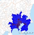
Tokyo-Kanto definitions, Kanto MMA 2015.png 600 × 619; 270 KB
-
Tokyo-Kanto definitions, Kanto MMA.png 600 × 619; 276 KB
-
Tokyo-Kanto definitions, Kanto region.png 600 × 619; 280 KB
-
Tokyo-Kanto definitions, National Capital Region.png 600 × 619; 281 KB
-
Tokyo-Kanto definitions, South Kanto.png 600 × 619; 271 KB
-
Tokyo-Kanto definitions, Tokyo MEA 2015.png 600 × 619; 144 KB
-
Tokyo-Kanto definitions, Tokyo UEA 2010.svg 601 × 628; 367 KB
-
Tokyo-Kanto definitions, Tokyo UEA.png 600 × 619; 273 KB
-
Tokyo-to map.jpg 1,245 × 1,048; 142 KB
-
Tomomasa map.png 300 × 290; 122 KB
-
Tone riverine system 16th century.png 480 × 285; 186 KB
-
Tone riverine system 20th century.png 480 × 285; 185 KB
-
坂東地方の牧場と街道.jpg 2,222 × 2,238; 2.27 MB
-
治承4年の関東.png 350 × 385; 15 KB
-
関東の郡界.jpg 9,017 × 8,969; 9.1 MB
-
간토지방구역도.png 5,000 × 7,250; 2.63 MB


