Category:Maps of Kagera Region
Jump to navigation
Jump to search
Media in category "Maps of Kagera Region"
The following 17 files are in this category, out of 17 total.
-
 Biharamulo District in Kagera 2022.svg 600 × 619; 484 KB
-
 Bukoba District in Kagera 2022.svg 600 × 619; 484 KB
-
 Bukoba Municipal in Kagera 2022.svg 600 × 619; 484 KB
-
 Karagwe District in Kagera 2022.svg 600 × 619; 484 KB
-
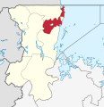
 Kyerwa District in Kagera 2022.svg 600 × 619; 484 KB
-
 Missenyi District in Kagera 2022.svg 600 × 619; 484 KB
-
 Muleba District in Kagera 2022.svg 600 × 619; 484 KB
-
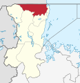
 Ngara District in Kagera 2022.svg 600 × 619; 484 KB
-
 Tanzania Biharamulo location map.svg 135 × 120; 1.46 MB
-
 Tanzania Bukoba Mjini location map.svg 135 × 120; 1.46 MB
-
 Tanzania Bukoba Vijijini location map.svg 135 × 120; 1.46 MB
-
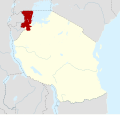 Tanzania Kagera location map.svg 3,302 × 3,143; 1.04 MB
-
 Tanzania Kagera location map2.svg 135 × 120; 1.46 MB
-
 Tanzania Kagera.png 536 × 546; 10 KB
-
 Tanzania Karagwe location map.svg 135 × 120; 1.46 MB
-
 Tanzania Muleba location map.svg 135 × 120; 1.46 MB
-
 Tanzania Ngara location map.svg 135 × 120; 1.46 MB


