Category:Maps of Kəlbəcər Rayon
Jump to navigation
Jump to search
Administrative territorial entity of Azerbaijan:
Districts: Abşeron · Ağcabədi · Ağdam · Ağdaş · Ağdərə · Ağstafa · Ağsu · Astara · Balakən · Beyləqan · Bərdə · Biləsuvar · Cəbrayıl · Cəlilabad · Daşkəsən · Füzuli · Gədəbəy · Goranboy · Göyçay · Göygöl · Hacıqabul · İmişli · İsmayıllı · Kəlbəcər · Kürdəmir · Laçın · Lerik · Lənkəran · Masallı · Neftçala · Oğuz · Qax · Qazax · Qobustan · Quba · Qubadlı · Qusar · Qəbələ · Saatlı · Sabirabad · Salyan · Samux · Siyəzən · Şabran · Şamaxı · Şəki · Şəmkir · Şuşa · Tərtər · Tovuz · Ucar · Xaçmaz · Xızı · Xocalı · Xocavənd · Yardımlı · Yevlax · Zaqatala · Zəngilan · ZərdabCities: Bakı (Baku) · Gəncə · Lənkəran · Mingəçevir · Naftalan · Sumqayıt · Şəki · Şirvan · Xankəndi · Yevlax
Autonomous Republic Nakhchivan with districts and one city: Babək · Culfa · Kəngərli · Naxçıvan · Ordubad · Sədərək · Şahbuz · Şərur
Media in category "Maps of Kəlbəcər Rayon"
The following 12 files are in this category, out of 12 total.
-
 A-Kalbacar.PNG 2,000 × 1,586; 141 KB
-
 Azerbaijan-Kalbajar.png 300 × 238; 12 KB
-
 Azerbaijan-KelbadjarDistrict (1994–2020).svg 1,200 × 919; 232 KB
-
 Kalbajar District in Azerbaijan 2021.svg 1,200 × 919; 408 KB
-
 Kalbajar District in Azerbaijan.svg 1,200 × 919; 394 KB
-
 Kalbajar in Azerbaijan (Artsakh hatched).svg 1,200 × 919; 271 KB
-
 Kalbajar in Azerbaijan (semi-secession).svg 1,200 × 919; 268 KB
-
 Kalbajar in Azerbaijan.svg 1,200 × 919; 268 KB
-
 Kelbajar Rayon.PNG 685 × 452; 75 KB
-
 Kəlbəcər rayonu, Kalbajar district- Aghaali Aghayev(Varsaman) project dna map AZE.png 6,716 × 3,956; 496 KB
-
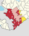 Seven occupied districts surrounding Nagorno-Karabakh (Numbered).png 921 × 1,116; 164 KB
-
 Seven occupied districts surrounding Nagorno-Karabakh.png 921 × 1,116; 158 KB


.svg)


.svg)
.svg)


_project_dna_map_AZE.png)
.png)
