Category:Maps of Køge
Jump to navigation
Jump to search
| NO WIKIDATA ID FOUND! Search for Maps of Køge on Wikidata | |
| Upload media |
Media in category "Maps of Køge"
The following 10 files are in this category, out of 10 total.
-
 1919-Plan-1024.jpg 683 × 1,024; 230 KB
-
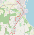
 A-bus Køge 2019 2.png 1,870 × 2,400; 2.32 MB
-
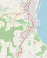
 A-bus Køge 2019.png 1,875 × 1,940; 2.05 MB
-
 Danmark - Koege1.jpg 482 × 599; 72 KB
-
 Denmark Railways 2006 Lille Syd.JPG 430 × 590; 42 KB
-
 Kaart over Slaget ved Kjöge, den 29de August 1807.jpg 2,224 × 2,532; 716 KB
-
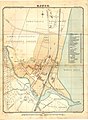
 Koege 1900.jpg 1,250 × 854; 636 KB
-
 Køge 1896.jpg 1,279 × 1,747; 483 KB
-
 Map DK Køge.PNG 465 × 550; 19 KB
-
 Openstreetmap - Køge A-bus 2020.png 1,800 × 2,200; 2.28 MB


