Category:Maps of Izaourt
Jump to navigation
Jump to search
Wikimedia category | |||||
| Upload media | |||||
| Instance of | |||||
|---|---|---|---|---|---|
| Category combines topics | |||||
| Izaourt | |||||
commune in Hautes-Pyrénées, France  .svg)  | |||||
| Instance of | |||||
| Location |
| ||||
| Population |
| ||||
| Area |
| ||||
 | |||||
Subcategories
This category has the following 3 subcategories, out of 3 total.
E
- Ecological maps of Izaourt (3 F)
G
- Geological maps of Izaourt (4 F)
T
- Topographic maps of Izaourt (3 F)
Media in category "Maps of Izaourt"
The following 9 files are in this category, out of 9 total.
-
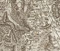 65 HP 13 4058.jpg 1,054 × 903; 358 KB
-
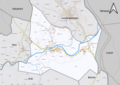
 65230-Izaourt - Localisation.png 2,000 × 2,480; 1.04 MB
-
 65230-Izaourt-argile.jpg 3,057 × 2,480; 448 KB
-
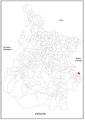
 65230-Izaourt-Cadastre.png 7,015 × 4,960; 5.18 MB
-
 65230-Izaourt-Hydro.png 7,015 × 4,960; 4.25 MB
-
 65230-Izaourt-Orthophoto.png 7,015 × 4,960; 3.72 MB
-
 65230-Izaourt-Sols.png 7,015 × 4,960; 4.29 MB
-
 Localisation d'Izaourt dans les Hautes-Pyrénées 1.pdf 1,754 × 2,481; 617 KB
-
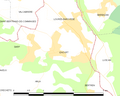 Map commune FR insee code 65230.png 756 × 605; 29 KB


