Category:Maps of Iringa Region
Jump to navigation
Jump to search
Media in category "Maps of Iringa Region"
The following 17 files are in this category, out of 17 total.
-
 Iringa and Alt-Iringa.png 354 × 165; 124 KB
-
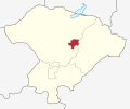
 Iringa District in Iringa 2022.svg 670 × 559; 467 KB
-
 Iringa Municipal in Iringa 2022.svg 670 × 559; 467 KB
-
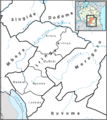 Iringa Regionen.png 902 × 1,013; 70 KB
-
 Kilolo District in Iringa 2022.svg 670 × 559; 467 KB
-
 Mafinga Town in Iringa 2022.svg 670 × 559; 467 KB
-
 Mufindi District in Iringa 2022.svg 670 × 559; 467 KB
-
 Tanzania Iringa location map.svg 3,302 × 3,143; 1.04 MB
-
 Tanzania Iringa location map2.svg 135 × 120; 1.46 MB
-
 Tanzania Iringa Mjini location map.svg 135 × 120; 1.46 MB
-
 Tanzania Iringa Vijijini location map.svg 135 × 120; 1.46 MB
-
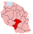 Tanzania Iringa.png 536 × 546; 10 KB
-
 Tanzania Kilolo location map.svg 135 × 120; 1.46 MB
-
 Tanzania Ludewa location map.svg 135 × 120; 1.46 MB
-
 Tanzania Makete location map.svg 135 × 120; 1.46 MB
-
 Tanzania Mufindi location map.svg 135 × 120; 1.46 MB
-
 Tanzania Njombe location map.svg 135 × 120; 1.46 MB


