Category:Maps of Innsbruck by Braun & Hogenberg
Jump to navigation
Jump to search
Media in category "Maps of Innsbruck by Braun & Hogenberg"
The following 19 files are in this category, out of 19 total.
-

-
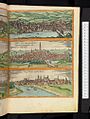
 De praecipvis totivs Vniversi vrbibvs, liber secvndvs 1575 (110201369).jpg 15,595 × 10,855; 32.29 MB
-
 De praecipvis totivs vniversi vrbibvs, liber secvndvs 1612 (109868476).jpg 16,469 × 10,859; 35.53 MB
-

-

-
 Oenipons, Tirolensis comitatus.png 625 × 510; 936 KB
-
 Beschreibung der Städt der Welt - Braun & Hogenberg - btv1b52512111k (313 of 378).jpg 8,419 × 6,392; 8.6 MB
-
-
 Oenipons, Tirolensis comitatus (Altstadt und Mariahilf).png 396 × 255; 182 KB
-
 Oenipons, Tirolensis comitatus (Vorstadt, Wilten und Ambras).png 330 × 240; 233 KB
-
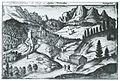
 Oenipons, Tirolensis comitatus (Weyerburg über Innsbruck).png 260 × 180; 138 KB
-

-
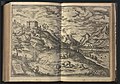 Vrbivm praecipvarvm Mvndi theatrvm qvintvm 1617 (112121917).jpg 7,706 × 5,379; 9.05 MB
-

-
 Innsbruck from the series Civitates Orbis Terrarum, vol. V, plate 59 MET DP817444.jpg 3,754 × 2,770; 3.7 MB
-
 Innsbruck from the series Civitates Orbis Terrarum, vol. V, plate 59 MET DP817445.jpg 3,753 × 2,791; 2.44 MB
-

-
 Schlossberg-1.jpg 1,978 × 1,342; 1.26 MB
-
 Vrbivm praecipvarvm Mvndi theatrvm qvintvm 1617 (112122031).jpg 7,689 × 5,324; 9.37 MB
.jpg)
.jpg)
.jpg)
.jpg)
.jpg)

.jpg)

.png)
.png)
.png)
.jpg)
.jpg)


.jpg)

.jpg)