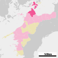
Category:Maps of Imabari, Ehime
Jump to navigation
Jump to search
Media in category "Maps of Imabari, Ehime"
The following 10 files are in this category, out of 10 total.
-
Admiralty Chart No 131 Kurushima Kaikyo, Published 1900, Large Corrections 1954.jpg 11,039 × 8,292; 32.35 MB
-
Ehime Tamagawa-town.png 320 × 260; 8 KB
-
Ehime-imabari-city.svg 792 × 797; 20 KB
-
Imabari in Ehime Prefecture Ja.svg 725 × 725; 27 KB
-
Iyo Amasaki fortress.jpg 298 × 438; 115 KB
-
Map Imabari en.png 1,281 × 801; 48 KB
-
Series L775, U.S. Army Map Service, 1946 (Kikuma Sheet 4649-2).jpg 4,057 × 3,615; 4.23 MB
-
今治市桜井周辺地図.jpg 1,251 × 792; 705 KB
-
基礎自治体位置図 38202.svg 730 × 802; 16 KB
-
大下島位置図.png 600 × 300; 90 KB


