Category:Maps of Hyderabad State
Jump to navigation
Jump to search
Media in category "Maps of Hyderabad State"
The following 14 files are in this category, out of 14 total.
-

-
 Hderabad State 1901.jpg 1,512 × 1,034; 612 KB
-
 Hyderabad and Berar 1903.gif 640 × 480; 329 KB
-
 Hyderabad and Berar 1903.jpg 640 × 480; 179 KB
-
 Hyderabad Boundaries and Railways - DPLA - cbaf432f34eac65162f01cf00600819d.jpg 4,672 × 3,377; 1.83 MB
-
 Hyderabad state 1909.jpg 1,000 × 790; 275 KB
-
 Hyderabad state from the Imperial Gazetteer of India, 1909.jpg 1,000 × 790; 389 KB
-
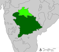
 Hyderabad State in British India 1940.png 1,621 × 1,469; 86 KB
-
 Hyderabad-godavari valley railways.jpg 845 × 612; 227 KB
-
 HyderIndKart.jpg 930 × 1,060; 94 KB
-
 India 1760-es.svg 2,151 × 2,546; 2.32 MB
-
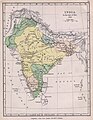 India1760 1905.jpg 1,154 × 1,485; 222 KB
-
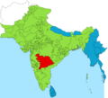
 Map of the Hyderabad princely state (1909).svg 800 × 702; 27 KB
-
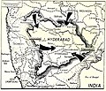 Operation Polo 1948.jpg 1,023 × 882; 163 KB
.jpg)


.svg)
