Category:Maps of Hyères
Jump to navigation
Jump to search
Wikimedia category | |||||
| Upload media | |||||
| Instance of | |||||
|---|---|---|---|---|---|
| Category combines topics | |||||
| Hyères | |||||
commune in Var, France    | |||||
| Instance of | |||||
| Location |
| ||||
| Population |
| ||||
| Area |
| ||||
| Elevation above sea level |
| ||||
| Different from | |||||
| official website | |||||
 | |||||
Subcategories
This category has the following 2 subcategories, out of 2 total.
L
- Maps of Levant island (14 F)
M
- Maps of Giens (7 F)
Media in category "Maps of Hyères"
The following 12 files are in this category, out of 12 total.
-
 "Plan de la Baye et Rades des Isles d'Hieres" (22218695686).jpg 3,267 × 2,429; 1.66 MB
-
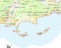
 83 - Hyères.png 507 × 454; 27 KB
-
 83069-Hyères-Hydro.jpeg 5,846 × 4,133; 2.85 MB
-
 Carte Provence. Îles d'Or. Stoechades. 1594.jpg 1,500 × 753; 323 KB
-

-
 FMIB 43903 Peninsula of Giens.jpeg 869 × 869; 266 KB
-
 Hyeres plan ville medievale.JPG 1,586 × 1,168; 1,001 KB
-
 Hyères-environs-1921-carte-29.jpg 2,250 × 1,803; 1.18 MB
-
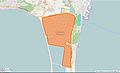
 Map commune FR insee code 83069.png 756 × 605; 105 KB
-
 Salin des Pesquiers.jpg 956 × 578; 82 KB
-
 Île du Levant. Portulan. Benincasa. 1466.jpg 683 × 621; 68 KB
-
 Îles d'Hyères. Portolan. Kitâb-ı Bahriye.jpg 473 × 714; 54 KB
.jpg)


.jpeg)


