Category:Maps of Hungary in the 16th century
Jump to navigation
Jump to search
English: This category is about the subject of  Hungary 1501-1600 CE: History maps showing all or a substantial part of the territory of Hungary as it was in the 16th century.
Contemporary old maps belong into: Category:16th-century maps of Hungary and its subcategories.
Contemporary old maps belong into: Category:16th-century maps of Hungary and its subcategories.
Media in category "Maps of Hungary in the 16th century"
The following 3 files are in this category, out of 3 total.
-
 Banlaky József történelmi térképe Magyarország 1527-1570.jpg 2,642 × 1,789; 832 KB
-
 C. 1699 Hungary (1526-1699).jpg 3,768 × 2,813; 5.94 MB
-
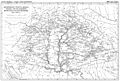
 Panství habsburské v XVI. století.jpg 952 × 823; 191 KB

.jpg)
