Category:Maps of Hudiksvall
Jump to navigation
Jump to search
Media in category "Maps of Hudiksvall"
The following 6 files are in this category, out of 6 total.
-
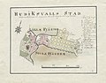 18th century map of Hudiksvall, Sweden.jpg 3,928 × 3,081; 753 KB
-
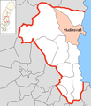 Hudiksvall Municipality in Gävleborg County.png 482 × 562; 23 KB
-
 Ljunggren Hudiksvall detaljkarta (cropped).png 1,979 × 1,165; 2.97 MB
-
 Ljunggren Hudiksvall.png 5,710 × 4,610; 31.97 MB
-
 Werming Hudiksvall.png 3,997 × 2,921; 14.47 MB
-
 Wiblingen Hudiksvall.png 2,276 × 1,788; 4.35 MB


.png)


