Category:Maps of Horst aan de Maas
Appearance
Wikimedia category | |||||
| Upload media | |||||
| Instance of | |||||
|---|---|---|---|---|---|
| Category combines topics | |||||
| Horst aan de Maas | |||||
municipality in Limburg, the Netherlands | |||||
| Instance of |
| ||||
| Location | Limburg, Netherlands | ||||
| Inception |
| ||||
| Population |
| ||||
| Area |
| ||||
| Elevation above sea level |
| ||||
| Replaces |
| ||||
| official website | |||||
 | |||||
Subcategories
This category has the following 3 subcategories, out of 3 total.
M
S
Media in category "Maps of Horst aan de Maas"
The following 15 files are in this category, out of 15 total.
-
2013-HorstaandeMaas.jpg 3,770 × 3,059; 6.29 MB
-
2013-Top33-gem-HorstaandeMaas.jpg 2,560 × 2,013; 3.2 MB
-
BAG woonplaatsen - Gemeente Horst aan de Maas.png 2,419 × 2,419; 1.13 MB
-
Gem-HorstaandeMaas-2014Q1.jpg 7,318 × 5,988; 16.09 MB
-
Gem-HorstaandeMaas-OpenTopo.jpg 9,029 × 7,143; 10.65 MB
-
Gem-HorstaandeMaas2-OpenTopo.jpg 9,160 × 7,334; 19.03 MB
-
Kaart Oostrumse Beek.png 528 × 424; 12 KB
-
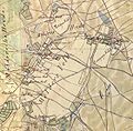
Kadastrale minuut Grubbenvorst, sectie D, blad 2.jpg 11,586 × 7,810; 6.79 MB
-
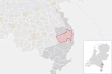
LocatieHorstAanDeMaas.png 280 × 130; 9 KB
-
Map - NL - Horst aan de Maas (2009).svg 625 × 575; 1.4 MB
-
Map - NL - Municipality code 1507 (2019).svg 300 × 160; 444 KB
-
NL - locator map municipality code GM1507 (2016).png 2,125 × 1,417; 405 KB
-
Ontginningsveld Melderslo Eikelenbos.JPG 482 × 285; 34 KB
-
Ontginningsvelden Melderslo-Melders Locht.JPG 559 × 551; 77 KB
-
Uitsnede van de kadastrale minuut Grubbenvorst, sectie D, blad 2.jpg 2,203 × 1,988; 1.07 MB


