Category:Maps of Hoogblokland
Jump to navigation
Jump to search
Wikimedia category | |||||
| Upload media | |||||
| Instance of | |||||
|---|---|---|---|---|---|
| Category combines topics | |||||
| Hoogblokland | |||||
farm village in the Netherlands    | |||||
| Instance of | |||||
| Location |
| ||||
| Population |
| ||||
 | |||||
Media in category "Maps of Hoogblokland"
The following 2 files are in this category, out of 2 total.
-
 Hoogblokland, Gemeenteatlas van Nederland.jpg 2,568 × 2,072; 1,006 KB
-
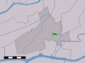 Map NL - Giessenlanden - Hoogblokland.png 800 × 600; 13 KB
