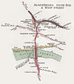
Category:Maps of Holborn Viaduct–Herne Hill line
Jump to navigation
Jump to search
Subcategories
This category has only the following subcategory.
M
Media in category "Maps of Holborn Viaduct–Herne Hill line"
The following 6 files are in this category, out of 6 total.
-
DISTRICT(1888) p106 - Ludgate Hill (map).jpg 464 × 926; 111 KB
-
Blackfriars snow hill RJD 1.jpg 1,282 × 1,472; 554 KB
-
Brixton rail lines.png 2,179 × 616; 879 KB
-
East brixton station map.png 685 × 368; 442 KB
-
Streatham & Tulse Hill Hastings & St Leonards RJD 100.jpg 2,816 × 1,760; 719 KB


