Category:Maps of Hochhausen (Tauberbischofsheim)
Jump to navigation
Jump to search
Subcategories
This category has the following 2 subcategories, out of 2 total.
Media in category "Maps of Hochhausen (Tauberbischofsheim)"
The following 7 files are in this category, out of 7 total.
-
 1914 Hochhausen (Tauberbischofsheim) - Bebauung.jpg 800 × 800; 113 KB
-
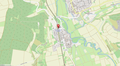
 Lage Bahnhof Hochhausen (Tauber) - Lage im Ort.png 300 × 440; 149 KB
-
 Lage Bahnhof Hochhausen (Tauber).png 1,421 × 781; 870 KB
-
 Lage ehemalige Synagoge Hochhausen (Tauberbischofsheim).png 1,863 × 782; 781 KB
-
 Lage Jüdischer Friedhof Hochhausen (Tauberbischofsheim).png 1,854 × 772; 886 KB
-
 Lage Wildgehege Hochhausen (Tauberbischofsheim).png 1,855 × 776; 1.01 MB
-

_-_Bebauung.jpg)
_-_Lage_im_Ort.png)
.png)
.png)
.png)
.png)
_Gemarkung_Hochhausen_(Tauberbischofsheim)_1914.jpg)