Category:Maps of Hill County, Montana
Jump to navigation
Jump to search
Counties of Montana: Beaverhead · Big Horn · Blaine · Broadwater · Carbon · Carter · Cascade · Chouteau · Custer · Daniels · Dawson · Deer Lodge · Fallon · Fergus · Flathead · Gallatin · Garfield · Glacier · Golden Valley · Granite · Hill · Jefferson · Judith Basin · Lake · Lewis and Clark · Liberty · Lincoln · Madison · McCone · Meagher · Mineral · Missoula · Musselshell · Park · Petroleum · Phillips · Pondera · Powder River · Powell · Prairie · Ravalli · Richland · Roosevelt · Rosebud · Sanders · Sheridan · Silver Bow · Stillwater · Sweet Grass · Teton · Toole · Treasure · Valley · Wheatland · Wibaux · Yellowstone
Wikimedia category | |||||
| Upload media | |||||
| Instance of | |||||
|---|---|---|---|---|---|
| Category combines topics | |||||
| Hill County | |||||
county in Montana, United States   | |||||
| Instance of | |||||
| Named after | |||||
| Location | Montana | ||||
| Capital | |||||
| Inception |
| ||||
| Population |
| ||||
| Area |
| ||||
| Different from | |||||
| official website | |||||
 | |||||
Subcategories
This category has only the following subcategory.
Media in category "Maps of Hill County, Montana"
The following 27 files are in this category, out of 27 total.
-

-
 Hill County Montana Incorporated and Unincorporated areas Agency Highlighted.svg 800 × 1,050; 123 KB
-
 Hill County Montana Incorporated and Unincorporated areas Azure Highlighted.svg 800 × 1,050; 123 KB
-

-

-
-

-

-
 Hill County Montana Incorporated and Unincorporated areas Herron Highlighted.svg 800 × 1,050; 123 KB
-

-

-

-

-

-
-

-

-

-
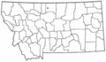
 Map of Montana highlighting Hill County.svg 2,043 × 1,178; 100 KB
-
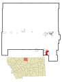
 MTMap-doton-Gildford.PNG 300 × 175; 12 KB
-
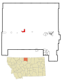
 MTMap-doton-Havre.PNG 300 × 175; 12 KB
-
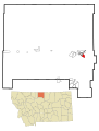
 MTMap-doton-Hingham.PNG 300 × 175; 12 KB
-
 MTMap-doton-Inverness.PNG 300 × 175; 12 KB
-
 MTMap-doton-Kremlin.PNG 300 × 175; 12 KB
-
 MTMap-doton-Rudyard.PNG 300 × 175; 12 KB
-
 MTMap-doton-WestHavre.PNG 300 × 175; 12 KB
-
 Topographic Map of Parts of Hill and Blaine Counties (pg 104).jpg 3,815 × 1,894; 1.61 MB
.jpg)


.jpg)