Category:Maps of Herford
Jump to navigation
Jump to search
Wikimedia category | |||||
| Upload media | |||||
| Instance of | |||||
|---|---|---|---|---|---|
| Category combines topics | |||||
| Herford | |||||
town in the Herford district, in North Rhine-Westphalia, Germany     | |||||
| Instance of |
| ||||
| Location | Herford, Detmold Government Region, North Rhine-Westphalia, Germany | ||||
| Head of government |
| ||||
| Population |
| ||||
| Area |
| ||||
| Elevation above sea level |
| ||||
| official website | |||||
 | |||||
Media in category "Maps of Herford"
The following 53 files are in this category, out of 53 total.
-
 2010-02-04 Herford 008.jpg 1,600 × 1,200; 614 KB
-
 52 Herford 28.1.png 575 × 717; 7 KB
-
 Abbey in Herford-Stadt.svg 1,196 × 1,196; 933 KB
-
 Altstadt in Herford-Stadt.svg 1,196 × 1,196; 933 KB
-
 Altstadt wo Abbey in Herford-Stadt.svg 1,196 × 1,196; 933 KB
-
 Altstädter Feldmark in Herford-Stadt.svg 1,196 × 1,196; 933 KB
-
 Feldmarken in Herford-Stadt.svg 1,196 × 1,196; 933 KB
-
 Friedenstal in Herford-Stadt.svg 1,196 × 1,196; 936 KB
-
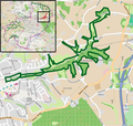
 Füllenbruch-Karte.JPG 2,680 × 1,848; 1.27 MB
-
 Herford - nature reserves.png 875 × 809; 972 KB
-
 Herford - NSG Asbeketal-Kinzbachtal - Map.png 1,278 × 694; 819 KB
-
 Herford - NSG Bramschebach-Nagelsbachtal - Map.png 843 × 649; 633 KB
-
 Herford - NSG Jammertal - Map.png 1,249 × 785; 602 KB
-
 Herford - NSG Uhlenbachtal - Map.png 777 × 737; 501 KB
-
 Herford 2009-12-16 (2).jpg 1,600 × 1,200; 641 KB
-
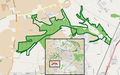
 Herford administrative divisions (with urban areas).svg 912 × 752; 921 KB
-
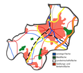
 Herford Flächennutzung.svg 912 × 752; 6.13 MB
-
 Herford Fraterhaus.jpg 681 × 750; 339 KB
-
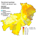
 Herford geothermische Karte.png 900 × 880; 70 KB
-
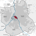
 Herford in HF (+urban).png 1,888 × 1,252; 824 KB
-
 Herford in HF (+urban).svg 1,888 × 1,252; 3.38 MB
-
 Herford in HF.svg 364 × 265; 252 KB
-
 Herford mapa geotèrmica.PNG 900 × 880; 68 KB
-
 Herford Ortsteile Diebrock.svg 1,480 × 1,355; 175 KB
-
 Herford Ortsteile Eickum.svg 1,480 × 1,355; 175 KB
-
 Herford Ortsteile Elverdissen.svg 1,480 × 1,355; 175 KB
-
 Herford Ortsteile Falkendiek.svg 1,480 × 1,355; 175 KB
-
 Herford Ortsteile Herford.svg 1,480 × 1,355; 176 KB
-
 Herford Ortsteile Herringhausen.svg 1,480 × 1,355; 175 KB
-
 Herford Ortsteile Laar.svg 1,480 × 1,355; 175 KB
-
 Herford Ortsteile Schwarzenmoor.svg 1,480 × 1,355; 175 KB
-
 Herford Ortsteile Stedefreund.svg 1,480 × 1,355; 175 KB
-
 Herford Ortsteile.svg 1,480 × 1,355; 176 KB
-
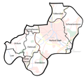 Herford-Admin.png 578 × 528; 107 KB
-
 Herford-Nutzung.png 576 × 509; 62 KB
-
 Herford-Physisch.png 556 × 501; 43 KB
-
 Herford-Stadt.svg 217 × 230; 5 KB
-
 Historic center in Herford-Stadt.svg 1,196 × 1,196; 933 KB
-
 K 30 1893 stadtzentrum 2.jpg 5,049 × 3,505; 5.06 MB
-
 Karte der Herforder Innenstadt 1893.jpg 5,049 × 3,505; 5.06 MB
-
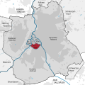
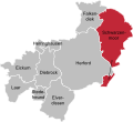
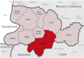 Kreis-Herford Herford.png 590 × 406; 54 KB
-
 Lage der Stadt Herford in Deutschland.png 188 × 235; 5 KB
-
 Neustadt in Herford-Stadt.svg 1,196 × 1,196; 933 KB
-
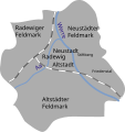
 Neustädter Feldmark in Herford-Stadt.svg 1,196 × 1,196; 933 KB
-
 Nordstadt in Herford-Stadt.svg 1,196 × 1,196; 936 KB
-
 Ovierview of Herford-Stadt.svg 1,196 × 1,196; 933 KB
-
 Ovierview with Abbey of Herford-Stadt.svg 1,196 × 1,196; 933 KB
-
 Ovierview with all parts of Herford-Stadt.svg 1,196 × 1,196; 936 KB
-
 Radewig in Herford-Stadt.svg 1,196 × 1,196; 933 KB
-
 Radewiger Feldmark in Herford-Stadt.svg 1,196 × 1,196; 933 KB
-
 Schulwall 5, 32052 Herford.png 1,355 × 815; 1.31 MB
-
 Stiftberg in Herford-Stadt.svg 1,196 × 1,196; 936 KB
-
 Waldfrieden in Herford-Stadt.svg 1,196 × 1,196; 936 KB


.jpg)
.svg)


.png)
.svg)


