Category:Maps of Hendaye
Jump to navigation
Jump to search
Wikimedia category | |||||
| Upload media | |||||
| Instance of | |||||
|---|---|---|---|---|---|
| Category combines topics | |||||
| Hendaye | |||||
commune in Pyrénées-Atlantiques, France    | |||||
| Pronunciation audio | |||||
| Instance of | |||||
| Location |
| ||||
| Population |
| ||||
| Area |
| ||||
| Elevation above sea level |
| ||||
| official website | |||||
 | |||||
Media in category "Maps of Hendaye"
The following 13 files are in this category, out of 13 total.
-
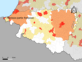 64-AAV2020-Hendaye (partie française).png 3,519 × 2,643; 1.65 MB
-
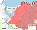
 64-Hendaye (partie française)-AAV2020.png 3,519 × 2,930; 557 KB
-
 64260-Hendaye-argile.jpg 3,057 × 2,480; 828 KB
-
 64260-Hendaye-Routes-Hydro.png 3,507 × 2,480; 3.26 MB
-
 64260-Hendaye-Sols.png 3,270 × 2,598; 3.29 MB
-
 64260-Hendaye-ZNIEFF1.png 3,057 × 2,480; 5.8 MB
-
 64260-Hendaye-ZNIEFF2.png 5,866 × 4,133; 10.82 MB
-
-
 Hendaye Limite communale.jpg 961 × 572; 178 KB
-
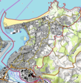
 Hendaye OSM 01.png 868 × 639; 339 KB
-
 Hendaye OSM 02.png 680 × 690; 462 KB
-
 Hendaye OSM 03.png 680 × 690; 304 KB
-
 Map commune FR insee code 64260.png 756 × 605; 63 KB
.png)
-AAV2020.png)


_-_dessin%C3%A9s_par..._-_btv1b52503974g_(061_of_106).jpg)


