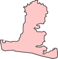
Category:Maps of Hayling Island
Jump to navigation
Jump to search
Media in category "Maps of Hayling Island"
The following 5 files are in this category, out of 5 total.
-
Admiralty Chart No 3418 Langston Harbour, Published 1943.jpg 8,815 × 13,201; 30.88 MB
-
Admiralty Chart No 3418 Langstone and Chichester Harbours, Published 1968.jpg 16,392 × 11,247; 91.53 MB
-
Hayling Island - The Three Harbours.svg 377 × 211; 1.99 MB
-
Map of Hayling Island, England.png 256 × 261; 5 KB


