Category:Maps of Hato Mayor Province
Jump to navigation
Jump to search
Provinces of the Dominican Republic: Azua · Bahoruco · Barahona · Dajabón · Duarte · El Seibo · Elías Piña · Espaillat · Hato Mayor · Hermanas Mirabal · Independencia · La Altagracia · La Romana · La Vega · María Trinidad Sánchez · Monseñor Nouel · Monte Cristi · Monte Plata · Pedernales · Peravia · Puerto Plata · Samaná · San Cristóbal · San José de Ocoa · San Juan · San Pedro de Macorís · Sánchez Ramírez · Santiago · Santiago Rodríguez · Santo Domingo · Valverde · Distrito Nacional
Media in category "Maps of Hato Mayor Province"
The following 10 files are in this category, out of 10 total.
-
 Hato Mayor in Dominican Republic.svg 1,400 × 1,139; 216 KB
-
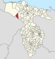
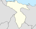
 Municipalities of Hato Mayor Province.jpg 400 × 400; 13 KB
-
 Arroyon (Sabana de la Mar).png 1,427 × 1,549; 492 KB
-
 Educacion Poblacional Hato Mayor.png 1,703 × 497; 46 KB
-
 Estructura de la poblacion por edad Hato Mayor.png 1,816 × 963; 147 KB
-
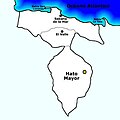
 Mapa Politico.jpg 716 × 924; 46 KB
-
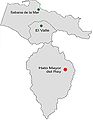
 Mapa Provincia Hato Mayor.png 1,405 × 1,143; 138 KB
-
 Poblacion de Hato Mayor por año.png 2,052 × 1,031; 50 KB
-
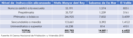
 Poblacion por municipio Hato Mayor.png 1,565 × 619; 68 KB
-
 Trepada Alta (Sabana de la Mar).png 1,444 × 1,560; 416 KB


.png)


.png)