Category:Maps of Harwich
Jump to navigation
Jump to search
Media in category "Maps of Harwich"
The following 14 files are in this category, out of 14 total.
-
 Admiralty Chart No 1408 Harwich to Terschelling and Cromer to Rotterdam, Published 1958.jpg 16,347 × 11,272; 47.22 MB
-
 Admiralty Chart No 1491 Harwich Harbour, Published 1959.jpg 16,129 × 11,032; 20.42 MB
-
 Admiralty Chart No 1610 North Foreland to Orfordness, Published 1933 Large Corrections 1947.jpg 13,567 × 11,258; 33.89 MB
-
 Admiralty Chart No 1610 North Foreland to Orfordness, Published 1953.jpg 16,395 × 11,326; 43.18 MB
-
 Admiralty Chart No 2052 The Naze to Orford Ness, Published 1966.jpg 16,324 × 11,222; 11.95 MB
-
 Admiralty Chart No 2693 Approaches to Harwich, Published 1966.jpg 16,312 × 11,223; 23.11 MB
-
 Admiralty Chart No 9 River Stour Harwich to Harkstead Point, Published 1911.jpg 8,280 × 6,132; 7.77 MB
-
 Harwich Dawson (1837).jpg 1,221 × 2,048; 298 KB
-
 Harwich from the Ordnance Survey, Dawson (1832).jpg 1,472 × 2,048; 361 KB
-
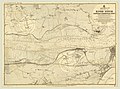
 Ordnance Survey One-Inch Sheet 150 Ipswich, Published 1946.jpg 11,004 × 12,810; 12.76 MB
-
 Ordnance Survey One-Inch Sheet 150 Ipswich, Published 1956.jpg 8,321 × 9,932; 8.12 MB
-
 Ordnance Survey One-Inch Sheet 150 Ipswich, Published 1969.jpg 8,278 × 9,900; 29.02 MB
-
 OSM map, Beacon Hill Fort, Harwich.png 805 × 702; 356 KB
-


.jpg)
.jpg)


.jpg)