Category:Maps of Halle (Westf.)- SVG available
Jump to navigation
Jump to search
Media in category "Maps of Halle (Westf.)- SVG available"
The following 4 files are in this category, out of 4 total.
-
 Halle geothermische Karte.png 820 × 800; 61 KB
-
 Halle Nutzung.png 1,020 × 915; 220 KB
-
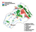
 Halle-(Westfalen) Naturschutzgebiete.png 1,020 × 915; 184 KB
-
 NSG Tatenhauser Wald.png 1,984 × 1,488; 393 KB


_Naturschutzgebiete.png)
