Category:Maps of Gulf of Finland
Jump to navigation
Jump to search
Wikimedia category | |||||
| Upload media | |||||
| Instance of | |||||
|---|---|---|---|---|---|
| Category combines topics | |||||
| Gulf of Finland | |||||
arm of the Baltic Sea | |||||
| Instance of | |||||
| Part of | |||||
| Named after | |||||
| Location |
| ||||
| Has part(s) |
| ||||
| Area |
| ||||
| Inflows |
| ||||
| Drainage basin | |||||
| Basin country | |||||
 | |||||
Subcategories
This category has the following 2 subcategories, out of 2 total.
M
- Maps of Vyborg Bay (23 F)
O
Media in category "Maps of Gulf of Finland"
The following 39 files are in this category, out of 39 total.
-
Admiralty Chart No 2248 Gulf of Finland Western Part, Published 1973.jpg 12,275 × 8,420; 11.55 MB
-
Baltic Sea map2 hr.svg 1,005 × 1,811; 559 KB
-
Baltic Sea map2 pt.svg 1,005 × 1,811; 2.73 MB
-
Baltic Sea map2.png 1,488 × 2,684; 1.25 MB
-
Baltic Sea map3 pt.svg 1,005 × 722; 732 KB
-
Baltic Sea map3.png 1,500 × 1,077; 632 KB
-
Basin lead to Gulf of Finland.svg 497 × 658; 824 KB
-
BHMW - Zatoka Fińska.jpg 3,000 × 2,278; 324 KB
-
Byer i Finskebukta.jpg 627 × 370; 123 KB
-
Estlink map.png 1,202 × 683; 149 KB
-
Finnischer meerbusen.gif 863 × 539; 42 KB
-
Finnischer Meerbusen.png 2,571 × 1,434; 259 KB
-
Finse golf.jpg 346 × 286; 16 KB
-
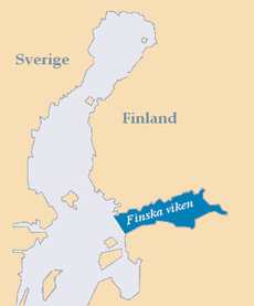
Finska viken.png 316 × 380; 8 KB
-
Gulf of RigaIT.png 752 × 1,117; 600 KB
-
La2-demis-gulf-of-finland.png 1,120 × 447; 70 KB
-
Leningrad area78.jpg 1,050 × 1,342; 152 KB
-
Map Gulf of Finland as.svg 1,400 × 800; 128 KB
-
Map Gulf of Finland ml.svg 1,400 × 800; 528 KB
-
Map Gulf of Finland-en.svg 1,400 × 800; 373 KB
-
Map Gulf of Finland-et.svg 1,400 × 800; 467 KB
-
Map Gulf of Finland-gu.svg 1,400 × 800; 28 KB
-
Map Gulf of Finland-hi.svg 1,400 × 800; 133 KB
-
Map Gulf of Finland-kn.svg 1,400 × 800; 169 KB
-
Map Gulf of Finland-mk.svg 1,400 × 800; 434 KB
-
Map Gulf of Finland-mr.svg 1,400 × 800; 133 KB
-
Map Gulf of Finland-pa.svg 1,400 × 800; 132 KB
-
Map Gulf of Finland-ru.svg 1,400 × 800; 373 KB
-
Map Gulf of Finland-ta.svg 1,400 × 800; 134 KB
-
Map Gulf of Finland-te.svg 1,400 × 800; 135 KB
-
Narva map.gif 772 × 501; 70 KB
-
Narvabukten.png 316 × 380; 4 KB
-
Rammu islands.png 596 × 547; 12 KB
-
River volkhov localization map.jpg 866 × 596; 342 KB
-
USSR map NO 34-3 Hango.jpg 5,719 × 4,372; 5.79 MB
-
USSR map NO 35-1 Tallinn.jpg 5,716 × 4,376; 5.59 MB
-
USSR map NO 35-2 Rakvere.jpg 4,941 × 4,362; 5.14 MB
-
Бассейн реки Невы - Neva valuma-alue.svg 497 × 658; 824 KB
-
Окрестности Санкт-петербурга фрагмент.jpg 1,890 × 1,299; 711 KB


