Category:Maps of Guarda
Jump to navigation
Jump to search
Subcategories
This category has only the following subcategory.
M
- Maps of freguesias of Guarda (6 F)
Media in category "Maps of Guarda"
The following 5 files are in this category, out of 5 total.
-
 Guarda location map.svg 599 × 878; 879 KB
-
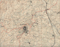 Guarda na Carta Militar 1936.png 1,284 × 1,001; 2.33 MB
-
 Kreis Guarda 2020.png 2,500 × 2,115; 957 KB
-
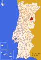 LocalGuarda.svg 250 × 366; 614 KB
-
 Royaumes d'Espagne et de Portugal 1780 Rigobert Bonne (detalle noroeste).jpg 1,318 × 1,066; 788 KB


.jpg)