Category:Maps of Guanabara (state)
Jump to navigation
Jump to search
Subcategories
This category has the following 2 subcategories, out of 2 total.
M
Media in category "Maps of Guanabara (state)"
The following 3 files are in this category, out of 3 total.
-
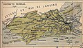 Mapa do Distrito Federal (Brasil) (1891–1960).jpg 1,339 × 779; 1.04 MB
-
 Mapa do Município Neutro (Brasil).png 499 × 349; 350 KB
-
 Rio-de-janeiro-antigo-1834-a-1975.jpg 600 × 433; 61 KB
_(1891%E2%80%931960).jpg)
.png)
