Category:Maps of Grenzach-Wyhlen
Jump to navigation
Jump to search
Pages in category "Maps of Grenzach-Wyhlen"
This category contains only the following page.
Media in category "Maps of Grenzach-Wyhlen"
The following 8 files are in this category, out of 8 total.
-
 Gemarkung Grenzach 1780.jpg 5,310 × 4,255; 2.73 MB
-
 Gemarkung Grenzach.jpg 4,397 × 4,033; 1.06 MB
-
 Gemarkung Wyhlen.jpg 4,331 × 3,998; 1.46 MB
-
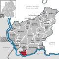
 Grenzach-Wyhlen in LÖ.png 299 × 299; 5 KB
-
 Grenzach-Wyhlen in LÖ.svg 540 × 540; 452 KB
-
 Jagdkarte Gemeinde Wyhlen in Baden 1920-21.jpg 3,376 × 2,660; 734 KB
-
 Nahverkehr in Grenzach-Wyhlen.png 756 × 378; 81 KB
-
 Topographische Karte der Gemeinde Grenzach-Wyhlen mit Gemeindegrenzen.png 1,800 × 1,334; 5.36 MB


