Category:Maps of Greater Kolkata
Jump to navigation
Jump to search
English: There are only a handful of free maps of the entire Greater Kolkata available at the Internet. For the official (but copyrighted) map of Greater Kolkata, see the official website of KMDA.
Subcategories
This category has the following 7 subcategories, out of 7 total.
- Maps of Barrackpore (28 F)
- Maps of Bidhannagar (3 F)
M
- Maps of the Kolkata Metro (25 F)
Media in category "Maps of Greater Kolkata"
The following 9 files are in this category, out of 9 total.
-
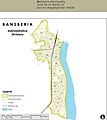
Bansberia Municipality Map.jpg 920 × 1,034; 105 KB
-
Calcutta tpc90.jpg 1,768 × 2,332; 1.39 MB
-
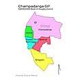
Chapadanga GP Map.jpg 800 × 800; 117 KB
-
Hooghly River 1749.jpg 436 × 658; 114 KB
-
Kolkata West International City.svg 974 × 423; 1.01 MB
-
Map of dankuni municipality.jpg 800 × 1,100; 254 KB
-
Map of Kolkata Airport.png 553 × 691; 456 KB
-
Map of uttarpara kotrung municipality.jpg 1,413 × 1,370; 218 KB
-
Serampore Municipality.jpg 960 × 960; 141 KB


