Category:Maps of Grand Duchy of Finland
Jump to navigation
Jump to search
Subcategories
This category has the following 3 subcategories, out of 3 total.
*
M
Media in category "Maps of Grand Duchy of Finland"
The following 17 files are in this category, out of 17 total.
-
Allgemeine Post- und Strassen-Karte des Russischen Reichs in Europa 01.jpg 5,373 × 4,929; 6.76 MB
-
Andreas Bureus map of Finland.jpg 3,328 × 2,800; 3.83 MB
-
Barkbröd i 1830-talets Finland.jpg 1,000 × 976; 238 KB
-
General Karte Vom Europäischen Russland und den kaukasischen Ländern 01.jpg 4,704 × 5,534; 7.15 MB
-
Gran Ducado de Finlandia.PNG 465 × 599; 22 KB
-
Grand duchy of finland 1662.jpg 2,271 × 1,878; 1.24 MB
-
Grand Duchy of Finland.png 794 × 428; 158 KB
-
Grand Principality of Finland (1914).svg 450 × 456; 456 KB
-
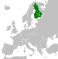
LocationFinland(1917-1918).png 250 × 125; 17 KB
-
Map of Grand Duchy of Finland, 1835.gif 1,453 × 2,313; 1.08 MB
-
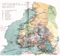
Map of railways in Russia, Grand Duchy of Finland, 1918.gif 1,043 × 965; 593 KB
-
Map of Tavastgus Governorate of the Grand Duchy of Finland, 1913.gif 942 × 1,205; 426 KB
-
Map of Uleaborg Governorate of the Grand Duchy of Finland, 1913.gif 960 × 1,199; 470 KB
-
Provinces of Grand Duchy of Finland numerated.svg 456 × 736; 69 KB
-
Provinces of Grand Duchy of Finland.svg 456 × 736; 65 KB
-
Schweden und Norwegen.jpg 4,549 × 5,527; 9.19 MB
-
Suomen suuriruhtinaskunnan kartta.png 351 × 753; 17 KB


