Category:Maps of Ghent by de Fer
Jump to navigation
Jump to search
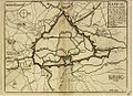
The maps in this category are all 98% identical but are published by different publishers at different dates. Some differ also in coloration.
Subcategories
This category has the following 2 subcategories, out of 2 total.
Media in category "Maps of Ghent by de Fer"
The following 13 files are in this category, out of 13 total.
-
 Ghent, Belgium, 1678.JPG 800 × 602; 102 KB
-
 Ghent, Belgium, Pieter van der Aa.jpg 3,899 × 3,085; 1.91 MB
-
 Ghent by De Fer, 1700.jpg 850 × 638; 132 KB
-
 Ghent by De Fer.jpg 1,001 × 726; 288 KB
-
 Map of Ghent by de Fer, bis.JPG 498 × 374; 25 KB
-
 Ghent, Belgium in 1705 by de Fer.jpg 452 × 372; 38 KB
-
 Map of Ghent by Nicholas de Fer, 1705.JPG 974 × 766; 207 KB
-
 Map of Ghent by Nicolas de Fer, Sébastien Le Prestre, Frederik Muller, 2.jpg 2,916 × 2,229; 4.53 MB
-
 Map of Ghent by Nicolas de Fer, Sébastien Le Prestre, Frederik Muller.jpg 2,612 × 2,069; 3.28 MB
-
 Map of Ghent by Nicolas De Fer.jpg 1,024 × 832; 281 KB
-
 Map of Ghent by Pieter Mortier.jpg 3,000 × 2,457; 3.24 MB
-
 Map of Ghent by Pieter Van Der Aa.jpg 2,886 × 1,990; 3.23 MB
-
 Old map of Ghent by De Fer.jpg 1,037 × 754; 217 KB


