Category:Maps of Gettysburg, Pennsylvania
Jump to navigation
Jump to search
Wikimedia category | |||||
| Upload media | |||||
| Instance of | |||||
|---|---|---|---|---|---|
| Category combines topics | |||||
| Gettysburg | |||||
borough and the county seat of Adams County in the U.S. state of Pennsylvania    | |||||
| Pronunciation audio | |||||
| Instance of | |||||
| Named after |
| ||||
| Location | Adams County, Pennsylvania | ||||
| Head of government |
| ||||
| Inception |
| ||||
| Population |
| ||||
| Area |
| ||||
| Elevation above sea level |
| ||||
| official website | |||||
 | |||||
Subcategories
This category has only the following subcategory.
C
Media in category "Maps of Gettysburg, Pennsylvania"
The following 20 files are in this category, out of 20 total.
-

-
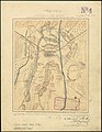
 Map of Gettysburg, Adams County, Pennsylvania Highlighted.png 1,688 × 1,162; 50 KB
-

-

-
 1902 Camp George G Meade.png 1,703 × 767; 239 KB
-
 1904 Cope map - Gettysburg Electric Railway.png 753 × 548; 922 KB
-
 1916 Gettysburg railyards.png 2,070 × 706; 2.84 MB
-
 Book of the Royal blue (1897) (14756013381).jpg 3,472 × 2,382; 1.18 MB
-

-
 Gettysburg and vicinity (5961388808).jpg 1,551 × 2,000; 2.62 MB
-
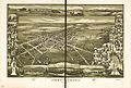 Gettysburg PA BEye view 1888.jpg 12,032 × 8,096; 21.86 MB
-
 Gettysburg, Pennsylvania 1888. LOC 75694978.jpg 12,032 × 8,096; 18.95 MB
-
 Gettysburg, Pennsylvania 1888. LOC 75694978.tif 12,032 × 8,096; 278.7 MB
-
 Lincoln at Gettysburg - an address (1909) (14741411196).jpg 2,597 × 2,209; 578 KB
-

-
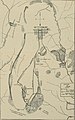
 Map of Gettysburg and its surroundings in 1863.png 1,073 × 1,252; 754 KB
-
 Philadelphia in the Civil War, 1861 1865 (1913) (14576063750).jpg 1,714 × 2,736; 501 KB
-

-
 The street railway review (1891) (14573162087).jpg 966 × 1,542; 175 KB
-


%27_(11192439406).jpg)
.jpg)


_(14756013381).jpg)
_(14759507762).jpg)
.jpg)


_(14741411196).jpg)
_(14804361353).jpg)

_(14576063750).jpg)
_(14571584080).jpg)
_(14573162087).jpg)
.jpg)