Category:Maps of Gdańsk
Jump to navigation
Jump to search
Wikimedia category | |||||
| Upload media | |||||
| Instance of | |||||
|---|---|---|---|---|---|
| Category combines topics | |||||
| Gdańsk | |||||
city and capital of the Pomeranian Voivodeship on the Baltic coast of northern Poland | |||||
| Instance of |
| ||||
| Part of |
| ||||
| Location |
| ||||
| Located in or next to body of water | |||||
| Head of government |
| ||||
| Inception |
| ||||
| Significant event |
| ||||
| Population |
| ||||
| Area |
| ||||
| Elevation above sea level |
| ||||
| Different from | |||||
| official website | |||||
 | |||||
Subcategories
This category has the following 5 subcategories, out of 5 total.
Media in category "Maps of Gdańsk"
The following 59 files are in this category, out of 59 total.
-
OSM-Gdańsk.png 2,633 × 1,501; 2.67 MB
-
Atlas of Heinrich Thomé - No 4. Danzigk wir es Eltere und newer werck.jpg 7,596 × 5,916; 3.51 MB
-
Bastion Sw. Gertrudy Gdansk 07.jpg 2,592 × 1,456; 1.23 MB
-
Bastion św. Gertrudy w Gdańsku (schemat).JPG 1,878 × 1,098; 777 KB
-
Claims of the Free City of Danzig in Exile.svg 680 × 520; 821 KB
-
Danzig in rt.GIF 497 × 465; 8 KB
-
Entstehung Bohnsacker Insel 1839-1895.png 3,508 × 7,600; 705 KB
-
Entstehung Bohnsacker Insel.gif 3,508 × 2,481; 260 KB
-
Gdansk map1.png 500 × 425; 58 KB
-
Gdansk Nowy Port.jpg 800 × 600; 116 KB
-
GdanskFootballTeamLocations.png 1,575 × 911; 1.13 MB
-
Gdańsk Cmentarz Oliwski (plan).JPG 4,017 × 3,014; 1.96 MB
-
Gdańsk location map.png 1,575 × 911; 384 KB
-
Gdańsk OSM 01.png 905 × 743; 519 KB
-
Gdańsk OSM 02.png 905 × 743; 874 KB
-
Gdańsk ulica Bytowska (plan).JPG 4,224 × 3,168; 6.04 MB
-
Gdańsk Zaspa – plan (nieaktualny) murali.JPG 4,224 × 2,376; 1.22 MB
-
Gdańsk Złota Karczma ulica Słowackiego (mapa).JPG 4,224 × 2,816; 2.37 MB
-
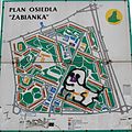
Gdańsk Żabianka plan.JPG 3,091 × 3,091; 1.59 MB
-
Jankowo Gdańskie OpenStreetMap.png 1,298 × 614; 531 KB
-
Karta över Danzig med Oliva utmärkt, 1703 - Skoklosters slott - 99043.tif 5,116 × 3,379, 2 pages; 49.48 MB
-
Karte Danziger Bucht.png 515 × 330; 127 KB
-
Linia PKM południe.jpg 457 × 457; 151 KB
-
Map - Special Collections University of Amsterdam - OTM- HB-KZL 31-09-18.tif 8,088 × 6,934; 160.45 MB
-
Map Gdansk 2009.png 3,500 × 2,398; 2.4 MB
-
Mapa Gdansk GDJ.png 1,382 × 1,102; 391 KB
-
Mapa miasta Danzig - lata 20. XX w.png 861 × 853; 874 KB
-
Mapa OMGGS.jpg 3,508 × 2,480; 717 KB
-
Mapa psstm.png 600 × 600; 124 KB
-
Mapa twierdzy tamerlan.svg 1,024 × 768; 204 KB
-
Norda 550x755 px.jpg 755 × 550; 128 KB
-
Oliwa park 02.jpg 1,024 × 768; 255 KB
-
Plan de la rivière de Dantzik et des environs - btv1b530096157.jpg 11,231 × 7,762; 11.67 MB
-
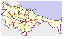
POL Gdańsk map.svg 497 × 463; 47 KB
-
POL rail 248 map.svg 502 × 454; 146 KB
-
Polandmap cia gdansk.png 246 × 400; 20 KB
-
Pomorski Inspektorat Okręgowy Straży Granicznej.jpg 1,089 × 870; 83 KB
-
Pomorskie Gdańsk.png 761 × 600; 137 KB
-
Pomorskie pomeranian voivodeship.png 600 × 473; 90 KB
-
Schemat danzig 1914.jpg 472 × 944; 59 KB
-
Srebrzysko cemetery in Gdansk map.JPG 2,545 × 1,697; 1.34 MB
-
Srodmiescie Gdansk.svg 595 × 545; 1.22 MB
-
Stare miasto Gdansk.svg 1,220 × 1,120; 173 KB
-
Tablica informacyjna - mapa - Dolina Strzyży (północ).jpg 4,160 × 2,340; 3.34 MB
-
Tereny.svg 670 × 606; 3 KB
-
Trako 2015 - tory ekspozycyjne B.svg 1,080 × 352; 315 KB
-
Trójmiasto location map.png 1,780 × 1,592; 1.44 MB
-
Trójmiejski Park Krajobrazowy (mapa).png 481 × 486; 351 KB
-
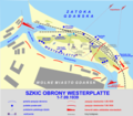
Westerplatte cs.PNG 1,910 × 1,668; 446 KB
-
Westerplatte en.PNG 7,644 × 6,669; 2.78 MB
-
Westerplatte maps 1.png 7,596 × 6,669; 2.84 MB
-
WK-20.jpg 243 × 268; 52 KB
-
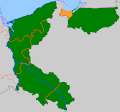
WMG-podz-adm.png 440 × 374; 9 KB
-
Wyspa Sobieszewska (mapa).PNG 958 × 638; 240 KB
-
Wyspa Sobieszewska, Gdańsk, Poland - panoramio (4).jpg 4,320 × 2,880; 5.06 MB
-
Danzig Witamy Zoo Übersicht 2015.JPG 4,000 × 2,248; 1.99 MB
-
Zsstg2.jpg 1,030 × 603; 70 KB
-
Zsstg25.jpg 1,029 × 603; 73 KB


