Category:Maps of Gauteng municipalities with 2009 borders
Jump to navigation
Jump to search
This category contains maps of municipalities in the Gauteng province of South Africa that show the the municipal borders as they were after the general election of 22 April 2009. The borders of many municipalities changed in 2011.
Media in category "Maps of Gauteng municipalities with 2009 borders"
The following 22 files are in this category, out of 22 total.
-
 Blank map of Gauteng (2009).svg 703 × 711; 446 KB
-
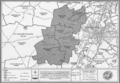
 Gauteng eastrand map.jpg 300 × 308; 83 KB
-
 Map No. 14 in Notice 1490 of 2008.png 2,910 × 2,010; 4.06 MB
-
 Map No. 4 in Notice 1490 of 2008.png 2,910 × 2,010; 4.31 MB
-
 Map of Gauteng with Ekurhuleni highlighted (2009).svg 754 × 760; 221 KB
-
 Map of Gauteng with Emfuleni highlighted (2009).svg 754 × 760; 222 KB
-
 Map of Gauteng with Johannesburg highlighted (2009).svg 754 × 760; 225 KB
-
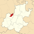
 Map of Gauteng with Kungwini highlighted (2009).svg 754 × 760; 220 KB
-
 Map of Gauteng with Lesedi highlighted (2009).svg 754 × 760; 223 KB
-
 Map of Gauteng with Merafong City highlighted (2009).svg 754 × 760; 218 KB
-
 Map of Gauteng with Metsweding highlighted (2009).svg 754 × 760; 225 KB
-
 Map of Gauteng with Midvaal highlighted (2009).svg 754 × 760; 229 KB
-
 Map of Gauteng with Mogale City highlighted (2009).svg 754 × 760; 219 KB
-
 Map of Gauteng with municipalities blank (2009).svg 754 × 760; 669 KB
-
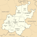 Map of Gauteng with municipalities labelled (2009).svg 754 × 760; 204 KB
-
 Map of Gauteng with Nokeng tsa Taemane highlighted (2009).svg 754 × 760; 219 KB
-
 Map of Gauteng with Randfontein highlighted (2009).svg 754 × 760; 215 KB
-
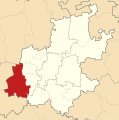
 Map of Gauteng with Sedibeng highlighted (2009).svg 754 × 760; 237 KB
-
 Map of Gauteng with the West Rand DMA highlighted (2009).svg 754 × 760; 213 KB
-
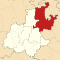
 Map of Gauteng with Tshwane highlighted (2009).svg 754 × 760; 222 KB
-
 Map of Gauteng with West Rand highlighted (2009).svg 754 × 760; 224 KB
-
 Map of Gauteng with Westonaria highlighted (2009).svg 754 × 760; 216 KB


.svg)
.svg)
.svg)
.svg)
.svg)
.svg)
.svg)
.svg)
.svg)
.svg)
.svg)
.svg)
.svg)
.svg)
.svg)
.svg)
.svg)
.svg)
.svg)