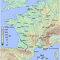
Category:Maps of Garonne River
Jump to navigation
Jump to search
Subcategories
This category has the following 6 subcategories, out of 6 total.
Media in category "Maps of Garonne River"
The following 11 files are in this category, out of 11 total.
-
Carte hydrologie naturelle garonne.png 1,633 × 1,553; 600 KB
-
Carte migrateurs garonne 1.png 1,563 × 1,978; 322 KB
-
Carte prelevements garonne.png 1,619 × 1,393; 698 KB
-
Carte soutien etiage garonne.png 1,403 × 1,390; 540 KB
-
FR81-Bassins.png 5,457 × 3,547; 2.26 MB
-
Garonne River Route.svg 2,000 × 1,922; 705 KB
-
Garonne watershed.png 1,287 × 843; 1.26 MB
-
MapGaronne.jpg 604 × 600; 402 KB
-
Rivières Lannemezan.JPG 508 × 521; 42 KB
-
Topographic map of Garonne and Adour.svg 642 × 627; 2.9 MB


