Category:Maps of Gütersloh
Jump to navigation
Jump to search
Kreis Gütersloh  Borgholzhausen · Gütersloh · Halle · Harsewinkel · Herzebrock-Clarholz · Langenberg · Rheda-Wiedenbrück · Rietberg · Schloß Holte-Stukenbrock · Steinhagen · Verl · Versmold · Werther ·
Wikimedia category | |||||
| Upload media | |||||
| Instance of | |||||
|---|---|---|---|---|---|
| Category combines topics | |||||
| Gütersloh | |||||
city in North Rhine-Westphalia, Germany | |||||
| Instance of |
| ||||
| Location | Gütersloh, Detmold Government Region, North Rhine-Westphalia, Germany | ||||
| Located in or next to body of water | |||||
| Head of government |
| ||||
| Population |
| ||||
| Area |
| ||||
| Elevation above sea level |
| ||||
| Different from | |||||
| official website | |||||
 | |||||
Media in category "Maps of Gütersloh"
The following 41 files are in this category, out of 41 total.
-
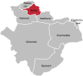
Admin Guetersloh GT.svg 549 × 502; 113 KB
-
Avenwedde in Gütersloh.svg 1,000 × 860; 1.86 MB
-
Blankenhagen in Gütersloh.svg 1,000 × 860; 1.86 MB
-
Ebbesloh in Gütersloh.svg 1,000 × 860; 1.86 MB
-
Flughafen in Gütersloh.svg 1,000 × 860; 1.86 MB
-
Friedrichsdorf in Gütersloh.svg 1,000 × 860; 1.86 MB
-
Gliederung GT.png 673 × 558; 74 KB
-
Gliederung Gütsel.png 783 × 649; 89 KB
-
Guetersloh in District of Guetersloh.png 544 × 547; 30 KB
-
Gütersloh - nature reserves.png 1,307 × 1,164; 1.76 MB
-
Gütersloh - NSG Am Lichtebach - Map.png 937 × 922; 467 KB
-
Gütersloh - NSG Am Lichtebach - Map.svg 628 × 526; 388 KB
-
Gütersloh - NSG Große Wiese - Map.png 824 × 738; 396 KB
-
Gütersloh - NSG Spexard - Map.png 756 × 736; 323 KB
-
Gütersloh - NSG Spexard - Map.svg 587 × 574; 312 KB
-
Gütersloh geothermische Karte.png 1,081 × 906; 62 KB
-
Gütersloh in GT.svg 485 × 470; 301 KB
-
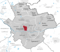
Gütersloh in Gütersloh.svg 1,000 × 860; 1.86 MB
-
Gütersloh Kern in Gütersloh.svg 1,000 × 860; 1.86 MB
-
Gütersloh subdivisions.svg 1,000 × 860; 1.86 MB
-
Hollen in Gütersloh.svg 1,000 × 860; 1.86 MB
-
Isselhorst in Gütersloh.svg 1,000 × 860; 1.86 MB
-
Kattenstroth in Gütersloh.svg 1,000 × 860; 1.86 MB
-
Lage der Stadt Gütersloh in Deutschland.png 188 × 235; 5 KB
-
Lage Gütersloh im Kreis Gütersloh.png 438 × 435; 22 KB
-
Lage von Gütersloh im Kreis Gütersloh.png 420 × 420; 50 KB
-
Niehorst in Gütersloh.svg 1,000 × 860; 1.86 MB
-
Nordhorn in Gütersloh.svg 1,000 × 860; 1.86 MB
-
North rhine w gt Guetersloh.png 843 × 843; 326 KB
-
Ortsteile Gütersloh - Avenwedde.svg 549 × 502; 113 KB
-
Ortsteile Gütersloh - Ebbesloh.svg 549 × 502; 113 KB
-
Ortsteile Gütersloh - Friedrichsdorf.svg 549 × 502; 113 KB
-
Ortsteile Gütersloh - Hollen.svg 549 × 502; 113 KB
-
Ortsteile Gütersloh - Isselhorst.svg 549 × 502; 113 KB
-
Ortsteile Gütersloh - Niehorst.svg 549 × 502; 113 KB
-
Ortsteile Gütersloh - Spexard.svg 549 × 502; 113 KB
-
Pavenstädt in Gütersloh.svg 1,000 × 860; 1.86 MB
-
Spexard in Gütersloh.svg 1,000 × 860; 1.86 MB
-
Sundern in Gütersloh.svg 1,000 × 860; 1.86 MB
-
Teutoburger Wald-Eisenbahn Strecke um 1925.jpg 415 × 600; 118 KB
