Category:Maps of Frisia
Jump to navigation
Jump to search
English: Note: Frisia is the whole of the following three geographical regions:
- West Frisia, the larger parts of the Dutch provinces of en:Friesland and en:Groningen.
- East Frisia, part of modern Germany's en:Lower Saxony.
- North Frisia, part of modern Germany's en:Schlesig-Holstein.
Please sort maps accordingly.
Subcategories
This category has the following 4 subcategories, out of 4 total.
L
M
O
Media in category "Maps of Frisia"
The following 21 files are in this category, out of 21 total.
-
 Europe location FRS.png 1,600 × 1,200; 716 KB
-
 Friesengebiet.png 769 × 697; 135 KB
-
 Friesland region.png 360 × 300; 16 KB
-
 Friezen en Franken.jpg 845 × 573; 102 KB
-
 Frisia 600-734-mk.svg 338 × 349; 117 KB
-
 Frisia 716-es.svg 622 × 642; 174 KB
-
 Frisia 716-la Arabic.jpg 726 × 758; 284 KB
-
 Frisia 716-la.svg 583 × 602; 197 KB
-
 Frisia 716-ru.svg 622 × 642; 67 KB
-
 Frisia map.svg 1,200 × 940; 267 KB
-
 Frisia-Orientale.svg 800 × 600; 895 KB
-
 Frisia.png 2,032 × 1,716; 132 KB
-
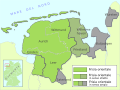
 Frisian counties.png 629 × 337; 11 KB
-
 Frisian kingdom.gif 945 × 885; 98 KB
-
 Frisian law.jpg 769 × 697; 196 KB
-
 Greveningen nieuw.jpg 989 × 918; 123 KB
-
 It Fryske ryk.jpg 301 × 335; 45 KB
-
 Juist 1805.jpg 944 × 548; 362 KB
-
 Lex Frisionum division.png 662 × 462; 11 KB
-
 Lex frisonum regions.jpg 769 × 697; 192 KB
-
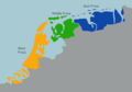
 Roricus Frisian fiefdom.png 500 × 355; 69 KB


